
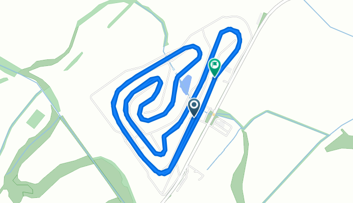
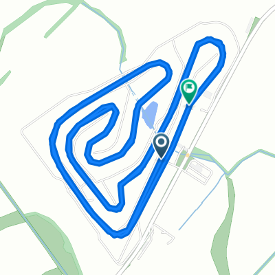
Diósförgepatony - Orechová Potôň, Diósförgepatony
A cycling route starting in Dunajská Streda, Trnava Region, Slovakia.
Overview
About this route
- 36 min
- Duration
- 11.8 km
- Distance
- 19 m
- Ascent
- 19 m
- Descent
- 19.7 km/h
- Avg. speed
- 123 m
- Max. altitude
Route quality
Waytypes & surfaces along the route
Waytypes
Cycleway
10.5 km
(89 %)
Access road
1.3 km
(11 %)
Surfaces
Paved
10.5 km
(89 %)
Asphalt
10.5 km
(89 %)
Undefined
1.3 km
(11 %)
Continue with Bikemap
Use, edit, or download this cycling route
You would like to ride Diósförgepatony - Orechová Potôň, Diósförgepatony or customize it for your own trip? Here is what you can do with this Bikemap route:
Free features
- Save this route as favorite or in collections
- Copy & plan your own version of this route
- Sync your route with Garmin or Wahoo
Premium features
Free trial for 3 days, or one-time payment. More about Bikemap Premium.
- Navigate this route on iOS & Android
- Export a GPX / KML file of this route
- Create your custom printout (try it for free)
- Download this route for offline navigation
Discover more Premium features.
Get Bikemap PremiumFrom our community
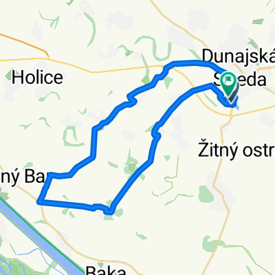
Other popular routes starting in Dunajská Streda
 Csicsó - zöld út
- Distance
- 59.9 km
- Ascent
- 15 m
- Descent
- 18 m
- Location
- Dunajská Streda, Trnava Region, Slovakia
 Nám Jána Kálvina, Dunaszerdahely - Dunajská Streda, Dunaszerdahely
- Distance
- 23.5 km
- Ascent
- 9 m
- Descent
- 12 m
- Location
- Dunajská Streda, Trnava Region, Slovakia
 Rekreačný rad do Dunajská Streda
- Distance
- 43.9 km
- Ascent
- 31 m
- Descent
- 83 m
- Location
- Dunajská Streda, Trnava Region, Slovakia
 Vodné mlyny
- Distance
- 41.3 km
- Ascent
- 12 m
- Descent
- 13 m
- Location
- Dunajská Streda, Trnava Region, Slovakia
 Gabčíkovská cesta, Dunajská Streda do Gabčíkovská cesta, Dunajská Streda
- Distance
- 31.5 km
- Ascent
- 32 m
- Descent
- 31 m
- Location
- Dunajská Streda, Trnava Region, Slovakia
 Diósförgepatony - Orechová Potôň, Diósförgepatony
- Distance
- 11.8 km
- Ascent
- 19 m
- Descent
- 19 m
- Location
- Dunajská Streda, Trnava Region, Slovakia
 Tour de Töltés
- Distance
- 68.3 km
- Ascent
- 49 m
- Descent
- 52 m
- Location
- Dunajská Streda, Trnava Region, Slovakia
 Pomalá jazda Tomášikovo
- Distance
- 25.7 km
- Ascent
- 52 m
- Descent
- 52 m
- Location
- Dunajská Streda, Trnava Region, Slovakia
Open it in the app