
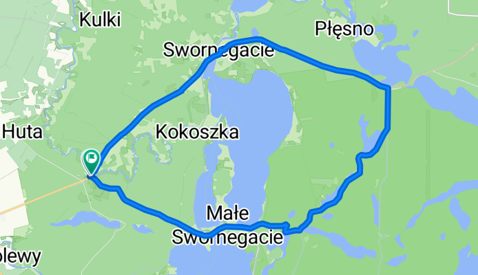
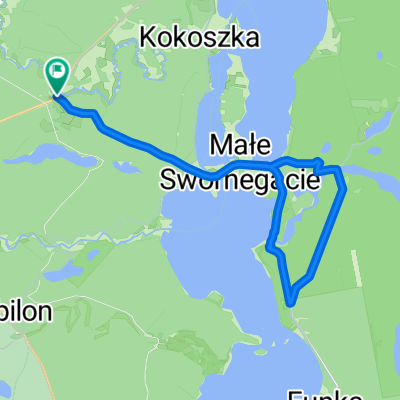
Pętla Chocimski Młyn
A cycling route starting in Przechlewo, Pomeranian Voivodeship, Poland.
Overview
About this route
- 1 h 43 min
- Duration
- 21.4 km
- Distance
- 153 m
- Ascent
- 156 m
- Descent
- 12.5 km/h
- Avg. speed
- 148 m
- Max. altitude

Route quality
Waytypes & surfaces along the route
Waytypes
Cycleway
13.1 km
(61 %)
Track
6.4 km
(30 %)
Surfaces
Paved
2.4 km
(11 %)
Unpaved
9.4 km
(44 %)
Gravel
4.3 km
(20 %)
Ground
4.3 km
(20 %)
Continue with Bikemap
Use, edit, or download this cycling route
You would like to ride Pętla Chocimski Młyn or customize it for your own trip? Here is what you can do with this Bikemap route:
Free features
- Save this route as favorite or in collections
- Copy & plan your own version of this route
- Sync your route with Garmin or Wahoo
Premium features
Free trial for 3 days, or one-time payment. More about Bikemap Premium.
- Navigate this route on iOS & Android
- Export a GPX / KML file of this route
- Create your custom printout (try it for free)
- Download this route for offline navigation
Discover more Premium features.
Get Bikemap PremiumFrom our community
Other popular routes starting in Przechlewo
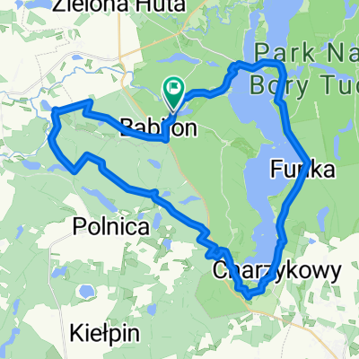 Charzykowy do 3A
- Distance
- 43 km
- Ascent
- 253 m
- Descent
- 283 m
- Location
- Przechlewo, Pomeranian Voivodeship, Poland
 Sąpolno, Przechlewo do Sąpolno, Przechlewo
- Distance
- 15 km
- Ascent
- 129 m
- Descent
- 129 m
- Location
- Przechlewo, Pomeranian Voivodeship, Poland
 Swornegacie nach Swornegacie
- Distance
- 22.5 km
- Ascent
- 272 m
- Descent
- 269 m
- Location
- Przechlewo, Pomeranian Voivodeship, Poland
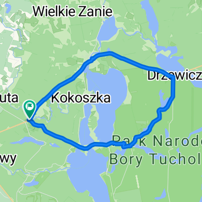
 Swornegacie do Chociński Młyn
- Distance
- 22.5 km
- Ascent
- 188 m
- Descent
- 214 m
- Location
- Przechlewo, Pomeranian Voivodeship, Poland
 Rzemieślnicza 7, Konarzyny do Rzemieślnicza 9, Konarzyny
- Distance
- 6.2 km
- Ascent
- 42 m
- Descent
- 45 m
- Location
- Przechlewo, Pomeranian Voivodeship, Poland
 Route in Gmina Chojnice
- Distance
- 17.4 km
- Ascent
- 152 m
- Descent
- 152 m
- Location
- Przechlewo, Pomeranian Voivodeship, Poland
 Zielona Huta 55A, Chojnice do Zielona Huta 55A, Chojnice
- Distance
- 42.1 km
- Ascent
- 469 m
- Descent
- 469 m
- Location
- Przechlewo, Pomeranian Voivodeship, Poland
 Pętla Chocimski Młyn
- Distance
- 21.4 km
- Ascent
- 153 m
- Descent
- 156 m
- Location
- Przechlewo, Pomeranian Voivodeship, Poland
Open it in the app