
Overview
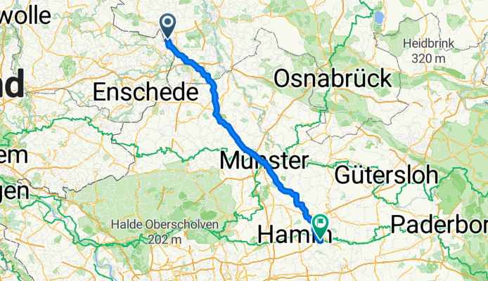
About this route
- 7 h 28 min
- Duration
- 128.3 km
- Distance
- 348 m
- Ascent
- 298 m
- Descent
- 17.2 km/h
- Avg. speed
- 113 m
- Max. altitude

Part of
Nordhorn - Passau
8 stages
Route quality
Waytypes & surfaces along the route
Waytypes
Path
62.5 km
(49 %)
Quiet road
44.2 km
(34 %)
Surfaces
Paved
113.4 km
(88 %)
Unpaved
5.2 km
(4 %)
Asphalt
105.9 km
(83 %)
Paved (undefined)
5.5 km
(4 %)
Continue with Bikemap
Use, edit, or download this cycling route
You would like to ride Nordhorn - Welver or customize it for your own trip? Here is what you can do with this Bikemap route:
Free features
- Save this route as favorite or in collections
- Copy & plan your own version of this route
- Split it into stages to create a multi-day tour
- Sync your route with Garmin or Wahoo
Premium features
Free trial for 3 days, or one-time payment. More about Bikemap Premium.
- Navigate this route on iOS & Android
- Export a GPX / KML file of this route
- Create your custom printout (try it for free)
- Download this route for offline navigation
Discover more Premium features.
Get Bikemap PremiumFrom our community
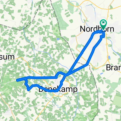
Other popular routes starting in Nordhorn
 20170623_091808.gpx
- Distance
- 27.1 km
- Ascent
- 28 m
- Descent
- 26 m
- Location
- Nordhorn, Lower Saxony, Germany
 20170623_091808.gpx
- Distance
- 27.1 km
- Ascent
- 44 m
- Descent
- 43 m
- Location
- Nordhorn, Lower Saxony, Germany
 Vechtetalroute bis Uelsen, dann Ootmarsum und am Almelo Kanal zurück
- Distance
- 58.9 km
- Ascent
- 401 m
- Descent
- 449 m
- Location
- Nordhorn, Lower Saxony, Germany
 Riverside-Denekamp-Hunebrug-Riverside
- Distance
- 29.2 km
- Ascent
- 49 m
- Descent
- 46 m
- Location
- Nordhorn, Lower Saxony, Germany
 Nordhorn-Klausheide Flugplatz-Nordhorn
- Distance
- 34.4 km
- Ascent
- 55 m
- Descent
- 57 m
- Location
- Nordhorn, Lower Saxony, Germany
 Nordhorn - Bookholt - Stadtflur - Klausheide - Flugplatz- Vechtesee
- Distance
- 30.4 km
- Ascent
- 29 m
- Descent
- 27 m
- Location
- Nordhorn, Lower Saxony, Germany
 1. Versuch 13,56 in 43 min
- Distance
- 13.6 km
- Ascent
- 181 m
- Descent
- 193 m
- Location
- Nordhorn, Lower Saxony, Germany
 Neubürgerroute 1
- Distance
- 17.9 km
- Ascent
- 22 m
- Descent
- 22 m
- Location
- Nordhorn, Lower Saxony, Germany
Open it in the app