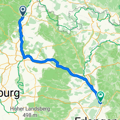
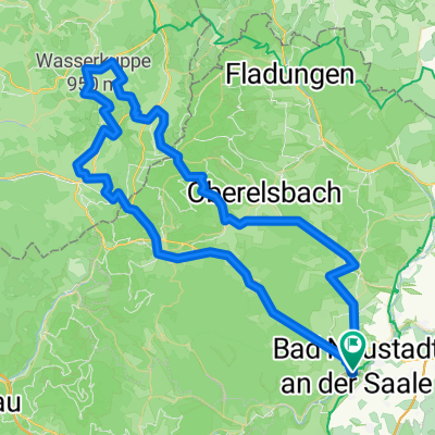
Nordhorn - Passau
Bad Neustadt an der Saale - Forchheim
A cycling route starting in Bad Neustadt an der Saale, Bavaria, Germany.
Overview
About this route
- 6 h 56 min
- Duration
- 122.6 km
- Distance
- 900 m
- Ascent
- 877 m
- Descent
- 17.7 km/h
- Avg. speed
- 391 m
- Max. altitude
Part of
Nordhorn - Passau
8 stages
Route quality
Waytypes & surfaces along the route
Waytypes
Path
63.7 km
(52 %)
Quiet road
23.5 km
(19 %)
Surfaces
Paved
116.7 km
(95 %)
Unpaved
4.2 km
(3 %)
Asphalt
113.3 km
(92 %)
Gravel
4.2 km
(3 %)
Continue with Bikemap
Use, edit, or download this cycling route
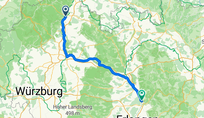
You would like to ride Bad Neustadt an der Saale - Forchheim or customize it for your own trip? Here is what you can do with this Bikemap route:
Free features
- Save this route as favorite or in collections
- Copy & plan your own version of this route
- Split it into stages to create a multi-day tour
- Sync your route with Garmin or Wahoo
Premium features
Free trial for 3 days, or one-time payment. More about Bikemap Premium.
- Navigate this route on iOS & Android
- Export a GPX / KML file of this route
- Create your custom printout (try it for free)
- Download this route for offline navigation
Discover more Premium features.
Get Bikemap PremiumFrom our community
Other popular routes starting in Bad Neustadt an der Saale
- Neustädter Haus
- Distance
- 41.2 km
- Ascent
- 564 m
- Descent
- 565 m
- Location
- Bad Neustadt an der Saale, Bavaria, Germany
- Tag2 Main-Rhön
- Distance
- 75 km
- Ascent
- 0 m
- Descent
- 0 m
- Location
- Bad Neustadt an der Saale, Bavaria, Germany
- Bad Neustadt A 158
- Distance
- 157.9 km
- Ascent
- 1,611 m
- Descent
- 1,611 m
- Location
- Bad Neustadt an der Saale, Bavaria, Germany
- Remap of Müller Dietmar's Buschwindröschen
- Distance
- 34.8 km
- Ascent
- 416 m
- Descent
- 417 m
- Location
- Bad Neustadt an der Saale, Bavaria, Germany
- Hollstadt Trail
- Distance
- 21.2 km
- Ascent
- 377 m
- Descent
- 377 m
- Location
- Bad Neustadt an der Saale, Bavaria, Germany
- XXI Erfurter Bike Challenge 2025
- Distance
- 269 km
- Ascent
- 2,648 m
- Descent
- 2,743 m
- Location
- Bad Neustadt an der Saale, Bavaria, Germany
- Röhn Kuppenritt 160 km
- Distance
- 157.6 km
- Ascent
- 2,167 m
- Descent
- 2,077 m
- Location
- Bad Neustadt an der Saale, Bavaria, Germany
- Vom Main zur Rhön
- Distance
- 256.8 km
- Ascent
- 801 m
- Descent
- 801 m
- Location
- Bad Neustadt an der Saale, Bavaria, Germany
Open it in the app