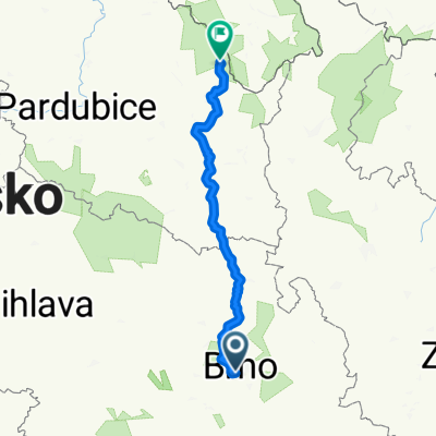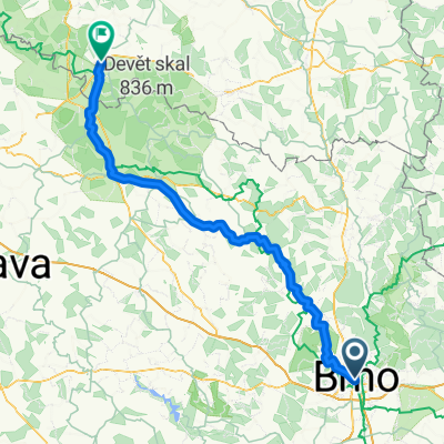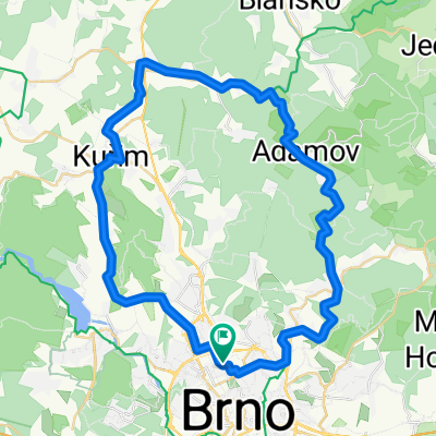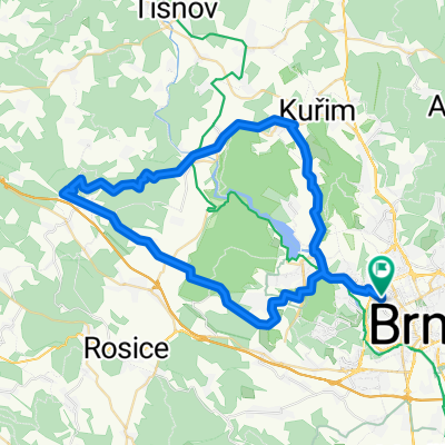
Start - Lap 1 - Lap 2 - Lap 3 - Lap 4 - Lap 5 - Lap 6 - Lap 7 - Lap 8 - Lap 9 - Lap 10 - Lap 11 - Lap 12 - End
- 55.4 km
- 1,368 m
- 1,365 m
- Brno, South Moravian, Czechia
A cycling route starting in Brno, South Moravian, Czechia.
Overview
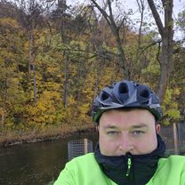
Mon May 12 07:14:41 GMT 2025 by ee798e2b-6bee-4831-999d-8fcbb420627eActivity Type:mountain_bikingEvent type:uncategorizedDistance:55.67 Kilometers Time :4:01:57Elevation Gain :735 Meters - Time:00:24:10Distance:5 Kilometers Elevation Gain:17 Meters Elevation Loss:59 Meters Max Speed:31.54 Kilometers per Hour - Time:00:23:30Distance:5 Kilometers Elevation Gain:173 Meters Elevation Loss:38 Meters Max Speed:23.35 Kilometers per Hour - Time:00:22:21Distance:5 Kilometers Elevation Gain:118 Meters Elevation Loss:28 Meters Max Speed:28.22 Kilometers per Hour - Time:00:17:16Distance:5 Kilometers Elevation Gain:68 Meters Elevation Loss:150 Meters Max Speed:37.55 Kilometers per Hour - Time:00:23:52Distance:5 Kilometers Elevation Gain:125 Meters Elevation Loss:29 Meters Max Speed:38.06 Kilometers per Hour - Time:00:18:43Distance:5 Kilometers Elevation Gain:24 Meters Elevation Loss:186 Meters Max Speed:44.14 Kilometers per Hour - Time:00:16:58Distance:5 Kilometers Elevation Gain:33 Meters Elevation Loss:100 Meters Max Speed:36.41 Kilometers per Hour - Time:00:18:11Distance:5 Kilometers Elevation Gain:41 Meters Elevation Loss:10 Meters Max Speed:20.86 Kilometers per Hour - Time:00:23:25Distance:5 Kilometers Elevation Gain:68 Meters Elevation Loss:30 Meters Max Speed:29.93 Kilometers per Hour - Time:00:30:49Distance:5 Kilometers Elevation Gain:9 Meters Elevation Loss:97 Meters Max Speed:39.91 Kilometers per Hour - Time:00:17:03Distance:5 Kilometers Elevation Gain:25 Meters Elevation Loss:11 Meters Max Speed:25.63 Kilometers per Hour - Time:00:05:35Distance:0.67 Kilometers Elevation Gain:34 Meters Elevation Loss:0 Meters Max Speed:16.16 Kilometers per Hour - Mon May 12 07:14:41 GMT 2025 by ee798e2b-6bee-4831-999d-8fcbb420627eActivity Type:mountain_bikingEvent type:uncategorizedDistance:55.67 Kilometers Time :4:01:57Elevation Gain :735 Meters
created this 4 months ago
Continue with Bikemap
You would like to ride Start - Lap 1 - Lap 2 - Lap 3 - Lap 4 - Lap 5 - Lap 6 - Lap 7 - Lap 8 - Lap 9 - Lap 10 - Lap 11 - Lap 12 - End or customize it for your own trip? Here is what you can do with this Bikemap route:
Free trial for 3 days, or one-time payment. More about Bikemap Premium.
Discover more Premium features.
Get Bikemap PremiumFrom our community
Open it in the app