
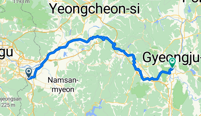
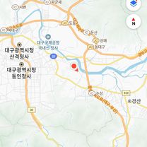
성암로5길, 경산시에서 성건동, 경주시까지
A cycling route starting in Gyeongsan-si, Gyeongsangbuk-do, South Korea.
Overview
About this route
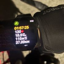
- 4 h 42 min
- Duration
- 70 km
- Distance
- 309 m
- Ascent
- 335 m
- Descent
- 14.9 km/h
- Avg. speed
- 127 m
- Max. altitude
Route photos


Route quality
Waytypes & surfaces along the route
Waytypes
Quiet road
42.8 km
(61 %)
Road
8.7 km
(12 %)
Surfaces
Paved
11 km
(16 %)
Asphalt
5.9 km
(8 %)
Paved (undefined)
5.2 km
(7 %)
Undefined
59 km
(84 %)
Continue with Bikemap
Use, edit, or download this cycling route
You would like to ride 성암로5길, 경산시에서 성건동, 경주시까지 or customize it for your own trip? Here is what you can do with this Bikemap route:
Free features
- Save this route as favorite or in collections
- Copy & plan your own version of this route
- Sync your route with Garmin or Wahoo
Premium features
Free trial for 3 days, or one-time payment. More about Bikemap Premium.
- Navigate this route on iOS & Android
- Export a GPX / KML file of this route
- Create your custom printout (try it for free)
- Download this route for offline navigation
Discover more Premium features.
Get Bikemap PremiumFrom our community
Other popular routes starting in Gyeongsan-si
 압량읍 47, 경산시 ~ 대한민국, 경산시
- Distance
- 2.1 km
- Ascent
- 99 m
- Descent
- 66 m
- Location
- Gyeongsan-si, Gyeongsangbuk-do, South Korea
 자인면 산45-1, 경산시 to 자인면 645-2, 경산시
- Distance
- 4.9 km
- Ascent
- 21 m
- Descent
- 11 m
- Location
- Gyeongsan-si, Gyeongsangbuk-do, South Korea
 정평동, 경산시에서 중방동, 경산시까지
- Distance
- 20.2 km
- Ascent
- 103 m
- Descent
- 105 m
- Location
- Gyeongsan-si, Gyeongsangbuk-do, South Korea
![용계동 467-1번지Ph0]으로 라우팅](https://media.bikemap.net/routes/17367028/staticmaps/in_f20611a3-2245-4ffb-8c23-fb0a25a820dc_400x400_bikemap-2021-3D-static.png) 용계동 467-1번지Ph0]으로 라우팅
용계동 467-1번지Ph0]으로 라우팅- Distance
- 8 km
- Ascent
- 15 m
- Descent
- 54 m
- Location
- Gyeongsan-si, Gyeongsangbuk-do, South Korea
![매호동 1099-68Ph0]으로 라우팅](https://media.bikemap.net/routes/14270143/staticmaps/in_912ade1c-95d7-4b35-ab9d-fcc0174a27cc_400x400_bikemap-2021-3D-static.png) 매호동 1099-68Ph0]으로 라우팅
매호동 1099-68Ph0]으로 라우팅- Distance
- 14.2 km
- Ascent
- 23 m
- Descent
- 78 m
- Location
- Gyeongsan-si, Gyeongsangbuk-do, South Korea
 편안한 경로
- Distance
- 6.4 km
- Ascent
- 115 m
- Descent
- 361 m
- Location
- Gyeongsan-si, Gyeongsangbuk-do, South Korea
 경산 남천 강변
- Distance
- 8.3 km
- Ascent
- 28 m
- Descent
- 25 m
- Location
- Gyeongsan-si, Gyeongsangbuk-do, South Korea
 성암로5길, 경산시에서 성건동, 경주시까지
- Distance
- 70 km
- Ascent
- 309 m
- Descent
- 335 m
- Location
- Gyeongsan-si, Gyeongsangbuk-do, South Korea
Open it in the app