

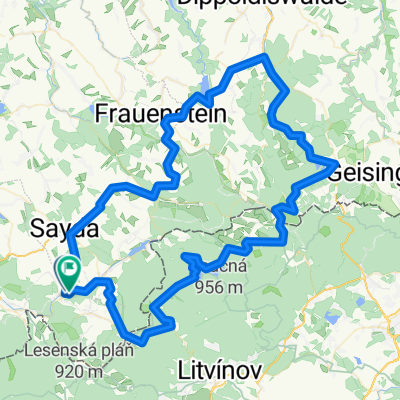
Heidersdorf-Frauenstein-Altenberg
A cycling route starting in Heidersdorf, Saxony, Germany.
Overview
About this route
- -:--
- Duration
- 101.8 km
- Distance
- 1,183 m
- Ascent
- 1,186 m
- Descent
- ---
- Avg. speed
- ---
- Max. altitude

Route quality
Waytypes & surfaces along the route
Waytypes
Busy road
71.9 km
(71 %)
Road
18.4 km
(18 %)
Surfaces
Paved
89.4 km
(88 %)
Unpaved
2.2 km
(2 %)
Asphalt
79.8 km
(78 %)
Paved (undefined)
8.5 km
(8 %)
Continue with Bikemap
Use, edit, or download this cycling route
You would like to ride Heidersdorf-Frauenstein-Altenberg or customize it for your own trip? Here is what you can do with this Bikemap route:
Free features
- Save this route as favorite or in collections
- Copy & plan your own version of this route
- Split it into stages to create a multi-day tour
- Sync your route with Garmin or Wahoo
Premium features
Free trial for 3 days, or one-time payment. More about Bikemap Premium.
- Navigate this route on iOS & Android
- Export a GPX / KML file of this route
- Create your custom printout (try it for free)
- Download this route for offline navigation
Discover more Premium features.
Get Bikemap PremiumFrom our community
Other popular routes starting in Heidersdorf
 MEK-Runde
- Distance
- 77.7 km
- Ascent
- 1,108 m
- Descent
- 1,063 m
- Location
- Heidersdorf, Saxony, Germany
 Sayda-Boxdorf
- Distance
- 73.4 km
- Ascent
- 639 m
- Descent
- 1,016 m
- Location
- Heidersdorf, Saxony, Germany
 Relhök
- Distance
- 6.2 km
- Ascent
- 92 m
- Descent
- 70 m
- Location
- Heidersdorf, Saxony, Germany
 Osterzgebirgsrunde
- Distance
- 71 km
- Ascent
- 789 m
- Descent
- 755 m
- Location
- Heidersdorf, Saxony, Germany
 Heidersdorf-Frauenstein-Altenberg
- Distance
- 101.8 km
- Ascent
- 1,183 m
- Descent
- 1,186 m
- Location
- Heidersdorf, Saxony, Germany
 Eisbeinrunde
- Distance
- 73 km
- Ascent
- 866 m
- Descent
- 866 m
- Location
- Heidersdorf, Saxony, Germany
 ERZGEBIRGSTOUR 2014 / ETAPPE 4
- Distance
- 68.4 km
- Ascent
- 988 m
- Descent
- 749 m
- Location
- Heidersdorf, Saxony, Germany
 Heidersdorf-Sayda-Olbernhau-Deutscheinsiedel
- Distance
- 48.6 km
- Ascent
- 521 m
- Descent
- 521 m
- Location
- Heidersdorf, Saxony, Germany
Open it in the app