
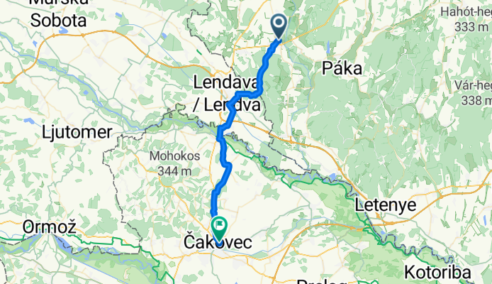
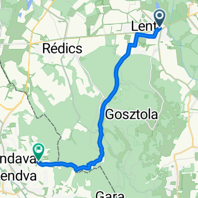
Hunyadi utca - Ulica kralja Tomislava
A cycling route starting in Lenti, Zala County, Hungary.
Overview
About this route
- 2 h 8 min
- Duration
- 35.3 km
- Distance
- 318 m
- Ascent
- 316 m
- Descent
- 16.6 km/h
- Avg. speed
- 329 m
- Max. altitude

Route quality
Waytypes & surfaces along the route
Waytypes
Quiet road
12.4 km
(35 %)
Road
7.8 km
(22 %)
Surfaces
Paved
28.6 km
(81 %)
Unpaved
1.1 km
(3 %)
Asphalt
26.8 km
(76 %)
Paved (undefined)
1.8 km
(5 %)
Continue with Bikemap
Use, edit, or download this cycling route
You would like to ride Hunyadi utca - Ulica kralja Tomislava or customize it for your own trip? Here is what you can do with this Bikemap route:
Free features
- Save this route as favorite or in collections
- Copy & plan your own version of this route
- Sync your route with Garmin or Wahoo
Premium features
Free trial for 3 days, or one-time payment. More about Bikemap Premium.
- Navigate this route on iOS & Android
- Export a GPX / KML file of this route
- Create your custom printout (try it for free)
- Download this route for offline navigation
Discover more Premium features.
Get Bikemap PremiumFrom our community
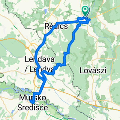
Other popular routes starting in Lenti
 Hunyadi utca - Hunyadi utca
- Distance
- 28.1 km
- Ascent
- 380 m
- Descent
- 427 m
- Location
- Lenti, Zala County, Hungary
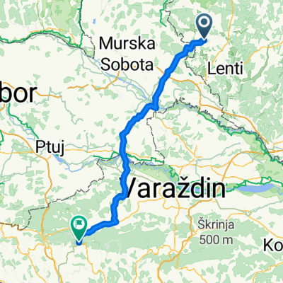 Kossuth Lajos utca - Novi Golubovec 15C
- Distance
- 89.6 km
- Ascent
- 733 m
- Descent
- 603 m
- Location
- Lenti, Zala County, Hungary
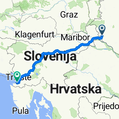 Lenti-Koper
- Distance
- 359 km
- Ascent
- 5,288 m
- Descent
- 5,449 m
- Location
- Lenti, Zala County, Hungary
 Ungarn nach Dolgovaške Gorice
- Distance
- 12.1 km
- Ascent
- 245 m
- Descent
- 116 m
- Location
- Lenti, Zala County, Hungary
 glockner1
- Distance
- 673.1 km
- Ascent
- 7,000 m
- Descent
- 5,254 m
- Location
- Lenti, Zala County, Hungary
 Hunyadi utca - Ulica kralja Tomislava
- Distance
- 35.3 km
- Ascent
- 318 m
- Descent
- 316 m
- Location
- Lenti, Zala County, Hungary
 Hunyadi utca - Hunyadi utca
- Distance
- 43.6 km
- Ascent
- 367 m
- Descent
- 413 m
- Location
- Lenti, Zala County, Hungary
 Nemesnép - Őriszentpéter
- Distance
- 39.8 km
- Ascent
- 285 m
- Descent
- 217 m
- Location
- Lenti, Zala County, Hungary
Open it in the app