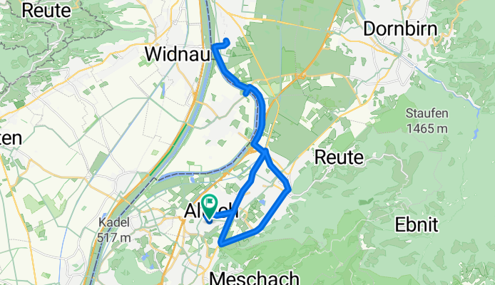
Sandholzerstraße to Sandholzerstraße
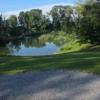
A cycling route starting in Altach, Vorarlberg, Austria.
Overview
About this route
- 1 h 18 min
- Duration
- 23.7 km
- Distance
- 54 m
- Ascent
- 103 m
- Descent
- 18.3 km/h
- Avg. speed
- 461 m
- Max. altitude
Route photos
Route quality
Waytypes & surfaces along the route
Waytypes
Busy road
7.3 km
(31 %)
Cycleway
7.3 km
(31 %)
Surfaces
Paved
22.7 km
(96 %)
Unpaved
1 km
(4 %)
Asphalt
22.7 km
(96 %)
Loose gravel
0.8 km
(4 %)
Continue with Bikemap
Use, edit, or download this cycling route
You would like to ride Sandholzerstraße to Sandholzerstraße or customize it for your own trip? Here is what you can do with this Bikemap route:
Free features
- Save this route as favorite or in collections
- Copy & plan your own version of this route
- Sync your route with Garmin or Wahoo
Premium features
Free trial for 3 days, or one-time payment. More about Bikemap Premium.
- Navigate this route on iOS & Android
- Export a GPX / KML file of this route
- Create your custom printout (try it for free)
- Download this route for offline navigation
Discover more Premium features.
Get Bikemap PremiumFrom our community
Other popular routes starting in Altach
- Trainigstour 1 MTB Marathon - 64km - 1534 hm
- Distance
- 66.4 km
- Ascent
- 1,395 m
- Descent
- 1,446 m
- Location
- Altach, Vorarlberg, Austria
- Altach-Zollikerberg
- Distance
- 140.8 km
- Ascent
- 1,569 m
- Descent
- 1,395 m
- Location
- Altach, Vorarlberg, Austria
- 4th Big One
- Distance
- 88.3 km
- Ascent
- 2,791 m
- Descent
- 2,790 m
- Location
- Altach, Vorarlberg, Austria
- Berkmannweg to Sandholzerstraße
- Distance
- 19.3 km
- Ascent
- 49 m
- Descent
- 100 m
- Location
- Altach, Vorarlberg, Austria
- Sandholzerstraße to Sandholzerstraße
- Distance
- 23.7 km
- Ascent
- 54 m
- Descent
- 103 m
- Location
- Altach, Vorarlberg, Austria
- Dornbirner Höhenweg - Buch 60 km - 650hm
- Distance
- 58.9 km
- Ascent
- 466 m
- Descent
- 468 m
- Location
- Altach, Vorarlberg, Austria
- Altach - Gsohl
- Distance
- 17.9 km
- Ascent
- 572 m
- Descent
- 575 m
- Location
- Altach, Vorarlberg, Austria
- Trainingsstrecke
- Distance
- 55.7 km
- Ascent
- 1,892 m
- Descent
- 1,892 m
- Location
- Altach, Vorarlberg, Austria
Open it in the app