
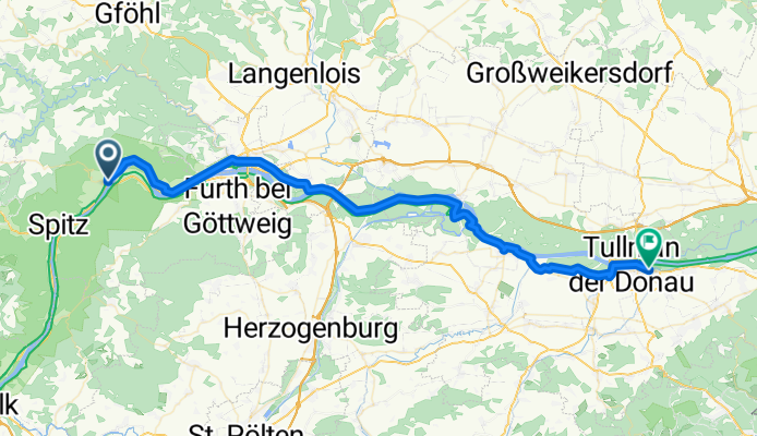
Landstraße, Weißenkirchen to Langenlebarner Straße, Tulln an der Donau
A cycling route starting in Weinzierl am Walde, Lower Austria, Austria.
Overview
About this route
- 3 h 57 min
- Duration
- 58.3 km
- Distance
- 259 m
- Ascent
- 302 m
- Descent
- 14.7 km/h
- Avg. speed
- 233 m
- Max. altitude

Route photos

Route quality
Waytypes & surfaces along the route
Waytypes
Track
26.2 km
(45 %)
Quiet road
8.7 km
(15 %)
Surfaces
Paved
56.5 km
(97 %)
Unpaved
0.6 km
(1 %)
Asphalt
56.5 km
(97 %)
Gravel
0.6 km
(1 %)
Undefined
1.2 km
(2 %)
Continue with Bikemap
Use, edit, or download this cycling route
You would like to ride Landstraße, Weißenkirchen to Langenlebarner Straße, Tulln an der Donau or customize it for your own trip? Here is what you can do with this Bikemap route:
Free features
- Save this route as favorite or in collections
- Copy & plan your own version of this route
- Sync your route with Garmin or Wahoo
Premium features
Free trial for 3 days, or one-time payment. More about Bikemap Premium.
- Navigate this route on iOS & Android
- Export a GPX / KML file of this route
- Create your custom printout (try it for free)
- Download this route for offline navigation
Discover more Premium features.
Get Bikemap PremiumFrom our community
Other popular routes starting in Weinzierl am Walde
 Landstraße, Weißenkirchen to Langenlebarner Straße, Tulln an der Donau
- Distance
- 58.3 km
- Ascent
- 259 m
- Descent
- 302 m
- Location
- Weinzierl am Walde, Lower Austria, Austria
 Von Weißenkirchen in der Wachau bis Schönbühel-Aggsbach
- Distance
- 13.8 km
- Ascent
- 179 m
- Descent
- 161 m
- Location
- Weinzierl am Walde, Lower Austria, Austria
 Weissenkirchen Groisbach Jauerling Spitz Weissenkirchen
- Distance
- 36.2 km
- Ascent
- 784 m
- Descent
- 781 m
- Location
- Weinzierl am Walde, Lower Austria, Austria
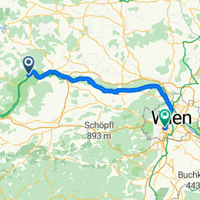 Aggsbach - Wien
- Distance
- 97.5 km
- Ascent
- 372 m
- Descent
- 368 m
- Location
- Weinzierl am Walde, Lower Austria, Austria
 Weissenkirchen-Langenlois-Krems-Weissenkirchen
- Distance
- 74.8 km
- Ascent
- 476 m
- Descent
- 476 m
- Location
- Weinzierl am Walde, Lower Austria, Austria
 Wachauaufahrt2013
- Distance
- 82.2 km
- Ascent
- 829 m
- Descent
- 184 m
- Location
- Weinzierl am Walde, Lower Austria, Austria
 Weissenkirchen Weinzierl Heinrichschlag Gschwendt Spitz
- Distance
- 30 km
- Ascent
- 722 m
- Descent
- 721 m
- Location
- Weinzierl am Walde, Lower Austria, Austria
 Weißenkirchen in der Wachau 132 nach Marstal 4
- Distance
- 19.2 km
- Ascent
- 568 m
- Descent
- 446 m
- Location
- Weinzierl am Walde, Lower Austria, Austria
Open it in the app