

Ricken -Schwägalp - Oberried - Wildhaus - Ricken
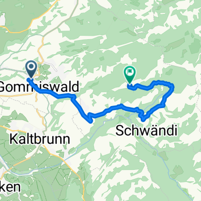
A cycling route starting in Gommiswald, Canton of St. Gallen, Switzerland.
Overview
About this route
- -:--
- Duration
- 126.6 km
- Distance
- 1,761 m
- Ascent
- 1,761 m
- Descent
- ---
- Avg. speed
- ---
- Max. altitude
Route quality
Waytypes & surfaces along the route
Waytypes
Quiet road
30.4 km
(24 %)
Road
20.2 km
(16 %)
Surfaces
Paved
121.5 km
(96 %)
Asphalt
121.5 km
(96 %)
Undefined
5.1 km
(4 %)
Route highlights
Points of interest along the route
Point of interest after 24.8 km
Point of interest after 25.2 km
Continue with Bikemap
Use, edit, or download this cycling route
You would like to ride Ricken -Schwägalp - Oberried - Wildhaus - Ricken or customize it for your own trip? Here is what you can do with this Bikemap route:
Free features
- Save this route as favorite or in collections
- Copy & plan your own version of this route
- Split it into stages to create a multi-day tour
- Sync your route with Garmin or Wahoo
Premium features
Free trial for 3 days, or one-time payment. More about Bikemap Premium.
- Navigate this route on iOS & Android
- Export a GPX / KML file of this route
- Create your custom printout (try it for free)
- Download this route for offline navigation
Discover more Premium features.
Get Bikemap PremiumFrom our community
Other popular routes starting in Gommiswald
 Uetliburg - Farneren
- Distance
- 31.6 km
- Ascent
- 947 m
- Descent
- 948 m
- Location
- Gommiswald, Canton of St. Gallen, Switzerland
 Moderate Route in Gommiswald
- Distance
- 10.5 km
- Ascent
- 946 m
- Descent
- 320 m
- Location
- Gommiswald, Canton of St. Gallen, Switzerland
 Ricken -Schwägalp - Oberried - Wildhaus - Ricken
- Distance
- 126.6 km
- Ascent
- 1,761 m
- Descent
- 1,761 m
- Location
- Gommiswald, Canton of St. Gallen, Switzerland
 Test1
Test1- Distance
- 17.1 km
- Ascent
- 239 m
- Descent
- 338 m
- Location
- Gommiswald, Canton of St. Gallen, Switzerland
 Toggenburg/Rheintal/Walensee
- Distance
- 125.8 km
- Ascent
- 1,271 m
- Descent
- 1,271 m
- Location
- Gommiswald, Canton of St. Gallen, Switzerland
 Mountainbike-Tour
- Distance
- 35.3 km
- Ascent
- 1,177 m
- Descent
- 1,174 m
- Location
- Gommiswald, Canton of St. Gallen, Switzerland
 Ricken SG, Rittmarren, Ernetschwil nach Ricken SG, Rittmarren, Ernetschwil
- Distance
- 37.9 km
- Ascent
- 1,204 m
- Descent
- 1,184 m
- Location
- Gommiswald, Canton of St. Gallen, Switzerland
 Klausenpass-Rundfahrt
- Distance
- 162 km
- Ascent
- 2,207 m
- Descent
- 2,207 m
- Location
- Gommiswald, Canton of St. Gallen, Switzerland
Open it in the app