

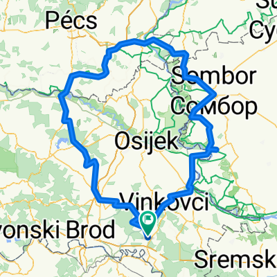
Gradište-Prkovci-Andrijaševci-Cerna-Gradište
A cycling route starting in Gradište, Vukovar-Srijem County, Croatia.
Overview
About this route
All asphalt. Great route where 80% of the road has very little traffic.
- -:--
- Duration
- 35.2 km
- Distance
- 46 m
- Ascent
- 47 m
- Descent
- ---
- Avg. speed
- ---
- Max. altitude
Route quality
Waytypes & surfaces along the route
Waytypes
Quiet road
3.5 km
(10 %)
Undefined
31.7 km
(90 %)
Surfaces
Paved
25 km
(71 %)
Asphalt
25 km
(71 %)
Undefined
10.2 km
(29 %)
Continue with Bikemap
Use, edit, or download this cycling route
You would like to ride Gradište-Prkovci-Andrijaševci-Cerna-Gradište or customize it for your own trip? Here is what you can do with this Bikemap route:
Free features
- Save this route as favorite or in collections
- Copy & plan your own version of this route
- Sync your route with Garmin or Wahoo
Premium features
Free trial for 3 days, or one-time payment. More about Bikemap Premium.
- Navigate this route on iOS & Android
- Export a GPX / KML file of this route
- Create your custom printout (try it for free)
- Download this route for offline navigation
Discover more Premium features.
Get Bikemap PremiumFrom our community
Other popular routes starting in Gradište
 berava stitar zupanja gradiste
- Distance
- 24.9 km
- Ascent
- 13 m
- Descent
- 15 m
- Location
- Gradište, Vukovar-Srijem County, Croatia
 Gradište-Cerna-BG-Štitar-Gradište
- Distance
- 39.1 km
- Ascent
- 28 m
- Descent
- 28 m
- Location
- Gradište, Vukovar-Srijem County, Croatia
 Gradište-Vjerovi
- Distance
- 20.1 km
- Ascent
- 78 m
- Descent
- 78 m
- Location
- Gradište, Vukovar-Srijem County, Croatia
 gradište-otok
- Distance
- 69.4 km
- Ascent
- 68 m
- Descent
- 70 m
- Location
- Gradište, Vukovar-Srijem County, Croatia
 Tuzla1
- Distance
- 95.3 km
- Ascent
- 553 m
- Descent
- 407 m
- Location
- Gradište, Vukovar-Srijem County, Croatia
 Harkany-Sombor-Gradište
- Distance
- 344.1 km
- Ascent
- 144 m
- Descent
- 143 m
- Location
- Gradište, Vukovar-Srijem County, Croatia
 Brčko-Tuzla-Orašje
- Distance
- 189.8 km
- Ascent
- 541 m
- Descent
- 542 m
- Location
- Gradište, Vukovar-Srijem County, Croatia
 Kladovac i Berava
- Distance
- 44 km
- Ascent
- 26 m
- Descent
- 28 m
- Location
- Gradište, Vukovar-Srijem County, Croatia
Open it in the app