
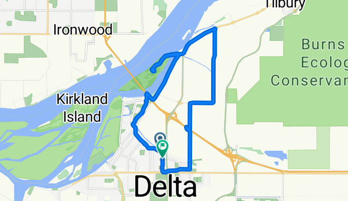
59th St, Delta to 59th St, Delta
A cycling route starting in Ladner, British Columbia, Canada.
Overview
About this route
- 57 min
- Duration
- 17.2 km
- Distance
- 187 m
- Ascent
- 187 m
- Descent
- 18 km/h
- Avg. speed
- 10 m
- Max. altitude
Route quality
Waytypes & surfaces along the route
Waytypes
Quiet road
8.4 km
(49 %)
Cycleway
4 km
(23 %)
Surfaces
Paved
10.3 km
(60 %)
Unpaved
2.6 km
(15 %)
Asphalt
8.8 km
(51 %)
Gravel
2.6 km
(15 %)
Continue with Bikemap
Use, edit, or download this cycling route
You would like to ride 59th St, Delta to 59th St, Delta or customize it for your own trip? Here is what you can do with this Bikemap route:
Free features
- Save this route as favorite or in collections
- Copy & plan your own version of this route
- Sync your route with Garmin or Wahoo
Premium features
Free trial for 3 days, or one-time payment. More about Bikemap Premium.
- Navigate this route on iOS & Android
- Export a GPX / KML file of this route
- Create your custom printout (try it for free)
- Download this route for offline navigation
Discover more Premium features.
Get Bikemap PremiumFrom our community
Other popular routes starting in Ladner
 59th St, Delta to 59th St, Delta
- Distance
- 44.7 km
- Ascent
- 112 m
- Descent
- 113 m
- Location
- Ladner, British Columbia, Canada
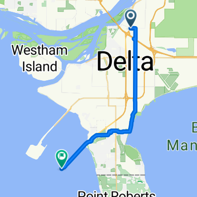
 Ferry Terminal
- Distance
- 6.6 km
- Ascent
- 22 m
- Descent
- 35 m
- Location
- Ladner, British Columbia, Canada
 Ladner Loop
- Distance
- 6.2 km
- Ascent
- 0 m
- Descent
- 3 m
- Location
- Ladner, British Columbia, Canada
 Four Winds route
- Distance
- 16.5 km
- Ascent
- 0 m
- Descent
- 12 m
- Location
- Ladner, British Columbia, Canada
 13292–13544 Gilbert Rd, Richmond to 8100–8286 Dyke Rd, Richmond
- Distance
- 20.6 km
- Ascent
- 50 m
- Descent
- 48 m
- Location
- Ladner, British Columbia, Canada
 59th St, Delta to 59th St, Delta
- Distance
- 17.2 km
- Ascent
- 187 m
- Descent
- 187 m
- Location
- Ladner, British Columbia, Canada
 Recovered Route
- Distance
- 47.6 km
- Ascent
- 12 m
- Descent
- 13 m
- Location
- Ladner, British Columbia, Canada
 Avenue to Ferry Ramp
- Distance
- 17.8 km
- Ascent
- 51 m
- Descent
- 31 m
- Location
- Ladner, British Columbia, Canada
Open it in the app