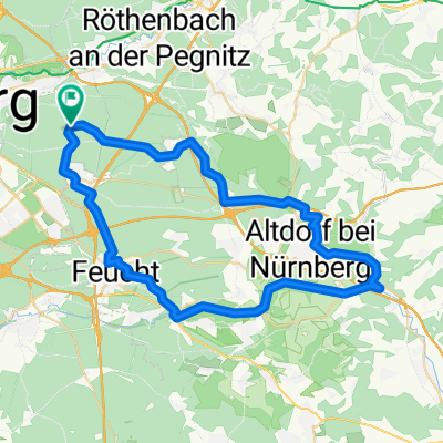
Schwaig - Osternohe - Hormersdorf - Hersbruck - Schwaig
- 63.9 km
- 432 m
- 432 m
- Schwaig, Bavaria, Germany
A cycling route starting in Schwaig, Bavaria, Germany.
Overview
Particularly nice is the approximately 3.5 km long climb between Osternohe and Hormersdorf. The route runs almost exclusively on secondary roads or cycle paths (e.g., along the B14).
created this 13 years ago
Route quality
Road
20.5 km
(32 %)
Quiet road
14.7 km
(23 %)
Paved
47.3 km
(74 %)
Asphalt
47.3 km
(74 %)
Undefined
16.6 km
(26 %)
Continue with Bikemap
You would like to ride Schwaig - Osternohe - Hormersdorf - Hersbruck - Schwaig or customize it for your own trip? Here is what you can do with this Bikemap route:
Free trial for 3 days, or one-time payment. More about Bikemap Premium.
Discover more Premium features.
Get Bikemap PremiumFrom our community
Open it in the app