
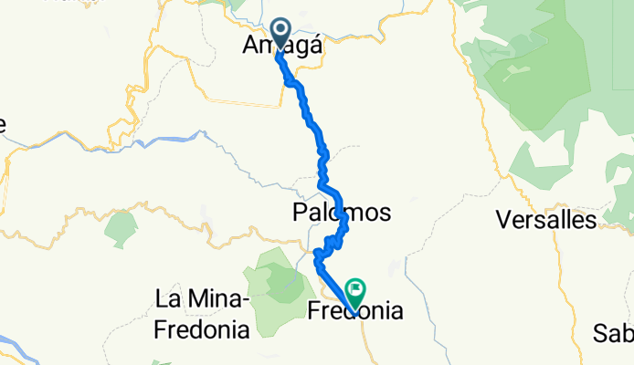
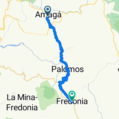
De Amaga a Carrera # 48-6
A cycling route starting in Amagá, Antioquia, Colombia.
Overview
About this route
- < 1 min
- Duration
- 19.4 km
- Distance
- 904 m
- Ascent
- 483 m
- Descent
- 2,906.1 km/h
- Avg. speed
- 1,812 m
- Max. altitude
Route quality
Waytypes & surfaces along the route
Waytypes
Quiet road
1 km
(5 %)
Road
0.8 km
(4 %)
Undefined
17.6 km
(91 %)
Surfaces
Paved
17.6 km
(91 %)
Asphalt
17.6 km
(91 %)
Undefined
1.7 km
(9 %)
Continue with Bikemap
Use, edit, or download this cycling route
You would like to ride De Amaga a Carrera # 48-6 or customize it for your own trip? Here is what you can do with this Bikemap route:
Free features
- Save this route as favorite or in collections
- Copy & plan your own version of this route
- Sync your route with Garmin or Wahoo
Premium features
Free trial for 3 days, or one-time payment. More about Bikemap Premium.
- Navigate this route on iOS & Android
- Export a GPX / KML file of this route
- Create your custom printout (try it for free)
- Download this route for offline navigation
Discover more Premium features.
Get Bikemap PremiumFrom our community
Other popular routes starting in Amagá
 De Amaga a Carrera # 48-6
- Distance
- 19.4 km
- Ascent
- 904 m
- Descent
- 483 m
- Location
- Amagá, Antioquia, Colombia
 6.013° N -75.652° W to 6.013° N -75.652° W
- Distance
- 19.3 km
- Ascent
- 837 m
- Descent
- 868 m
- Location
- Amagá, Antioquia, Colombia
 De Amagá a Calle 53 51-62, Amaga
- Distance
- 5.3 km
- Ascent
- 151 m
- Descent
- 341 m
- Location
- Amagá, Antioquia, Colombia
 De Carrera 54 45-25, Amaga a Calle 104 70-18, Medellín
- Distance
- 63.1 km
- Ascent
- 1,057 m
- Descent
- 910 m
- Location
- Amagá, Antioquia, Colombia
 Viaducto Amaga
- Distance
- 18.8 km
- Ascent
- 549 m
- Descent
- 554 m
- Location
- Amagá, Antioquia, Colombia
 Ruta a ÄÃ{È?
- Distance
- 15.2 km
- Ascent
- 430 m
- Descent
- 556 m
- Location
- Amagá, Antioquia, Colombia
 De Calle 53 51-62, Amaga a Amagá
- Distance
- 5.7 km
- Ascent
- 539 m
- Descent
- 342 m
- Location
- Amagá, Antioquia, Colombia
 2BAmaga-Hispania
- Distance
- 57.7 km
- Ascent
- 783 m
- Descent
- 1,218 m
- Location
- Amagá, Antioquia, Colombia
Open it in the app