
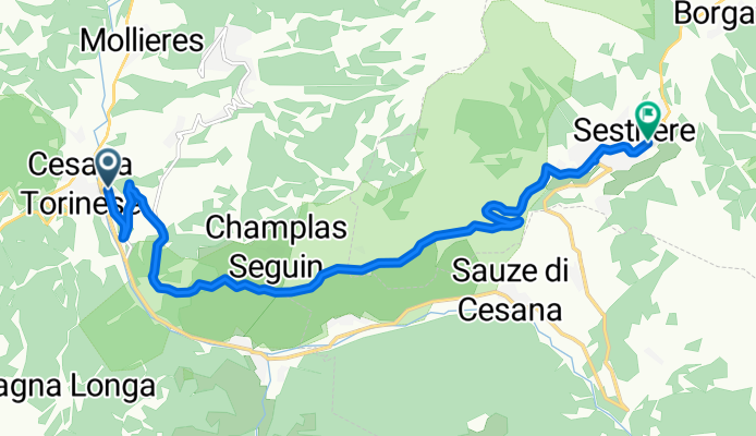
COLLE DEL SESTRIERE (por Cesana Torinese)
A cycling route starting in Cesana Torinese, Piedmont, Italy.
Overview
About this route
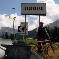
The Colle del Sestriere, at 2035 meters altitude, is one of the best-known Alpine passes in Piedmont, in the province of Turin. It is located in the heart of the Cottian Alps chain and serves as a link between the Susa Valley and the Val Chisone. At its highest point stands the modern town of Sestriere, a tourist hub born in the 1930s that today is an international reference for skiing and other mountain sports.
- 49 min
- Duration
- 11.7 km
- Distance
- 856 m
- Ascent
- 166 m
- Descent
- 14.4 km/h
- Avg. speed
- 2,037 m
- Max. altitude

Route photos
\"")
Route quality
Waytypes & surfaces along the route
Surfaces
Paved
11 km
(94 %)
Asphalt
11 km
(94 %)
Undefined
0.7 km
(6 %)
Continue with Bikemap
Use, edit, or download this cycling route
You would like to ride COLLE DEL SESTRIERE (por Cesana Torinese) or customize it for your own trip? Here is what you can do with this Bikemap route:
Free features
- Save this route as favorite or in collections
- Copy & plan your own version of this route
- Sync your route with Garmin or Wahoo
Premium features
Free trial for 3 days, or one-time payment. More about Bikemap Premium.
- Navigate this route on iOS & Android
- Export a GPX / KML file of this route
- Create your custom printout (try it for free)
- Download this route for offline navigation
Discover more Premium features.
Get Bikemap PremiumFrom our community
Other popular routes starting in Cesana Torinese
 23/07/12 Cesana- Briancon - Guillestre - Izoard - Briancon
- Distance
- 107.4 km
- Ascent
- 2,106 m
- Descent
- 2,256 m
- Location
- Cesana Torinese, Piedmont, Italy
 cesana lago nero thures
- Distance
- 27.8 km
- Ascent
- 891 m
- Descent
- 891 m
- Location
- Cesana Torinese, Piedmont, Italy
 Tappa 07 17 agosto 2018 Sfida al Campione
- Distance
- 12.6 km
- Ascent
- 670 m
- Descent
- 14 m
- Location
- Cesana Torinese, Piedmont, Italy
 Cesana Torinese - Cuorgnè
- Distance
- 179.6 km
- Ascent
- 1,927 m
- Descent
- 2,867 m
- Location
- Cesana Torinese, Piedmont, Italy
 COLLE DEL SESTRIERE (por Cesana Torinese)
- Distance
- 11.7 km
- Ascent
- 856 m
- Descent
- 166 m
- Location
- Cesana Torinese, Piedmont, Italy
 Mont Chaberton
- Distance
- 36.8 km
- Ascent
- 1,874 m
- Descent
- 1,874 m
- Location
- Cesana Torinese, Piedmont, Italy
 Tappa 03 14 agosto 2018 - Galibier 1 di 2
- Distance
- 113.5 km
- Ascent
- 2,238 m
- Descent
- 2,560 m
- Location
- Cesana Torinese, Piedmont, Italy
 Chaberton Runde
- Distance
- 31.7 km
- Ascent
- 1,848 m
- Descent
- 1,853 m
- Location
- Cesana Torinese, Piedmont, Italy
Open it in the app