
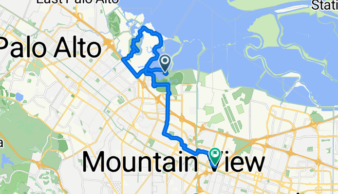
Shoreline Park Trail, Mountain View to Nicholas Dr, Mountain View
A cycling route starting in Palo Alto, California, United States.
Overview
About this route
- < 1 min
- Duration
- 20.1 km
- Distance
- 68 m
- Ascent
- 45 m
- Descent
- 72,471 km/h
- Avg. speed
- 31 m
- Max. altitude

Route photos


Route quality
Waytypes & surfaces along the route
Waytypes
Path
7 km
(35 %)
Cycleway
5.4 km
(27 %)
Surfaces
Paved
12.1 km
(60 %)
Unpaved
6.2 km
(31 %)
Asphalt
9.9 km
(49 %)
Gravel
5.2 km
(26 %)
Continue with Bikemap
Use, edit, or download this cycling route
You would like to ride Shoreline Park Trail, Mountain View to Nicholas Dr, Mountain View or customize it for your own trip? Here is what you can do with this Bikemap route:
Free features
- Save this route as favorite or in collections
- Copy & plan your own version of this route
- Sync your route with Garmin or Wahoo
Premium features
Free trial for 3 days, or one-time payment. More about Bikemap Premium.
- Navigate this route on iOS & Android
- Export a GPX / KML file of this route
- Create your custom printout (try it for free)
- Download this route for offline navigation
Discover more Premium features.
Get Bikemap PremiumFrom our community
Other popular routes starting in Palo Alto
 PA -> SRWC
- Distance
- 11.4 km
- Ascent
- 12 m
- Descent
- 17 m
- Location
- Palo Alto, California, United States
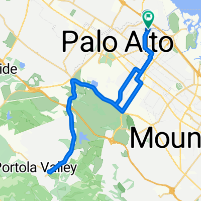
 The Big Loop
- Distance
- 50 km
- Ascent
- 493 m
- Descent
- 492 m
- Location
- Palo Alto, California, United States
 Edgewood Drive to Edgewood Drive
- Distance
- 34.2 km
- Ascent
- 386 m
- Descent
- 330 m
- Location
- Palo Alto, California, United States
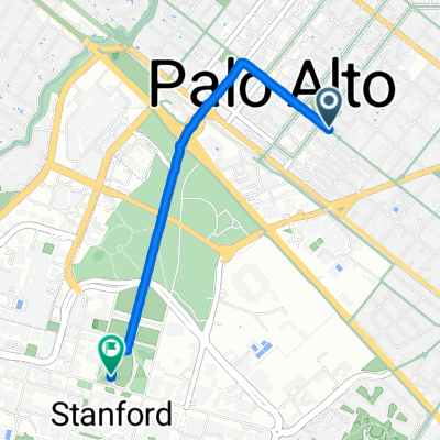 Addison Ave, パロアルトへJane Stanford Way, スタンフォード
- Distance
- 3.1 km
- Ascent
- 19 m
- Descent
- 10 m
- Location
- Palo Alto, California, United States
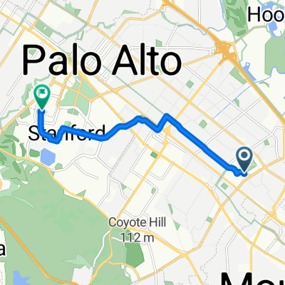
 Mollie to near 101
- Distance
- 4.8 km
- Ascent
- 4 m
- Descent
- 4 m
- Location
- Palo Alto, California, United States
 Portola and Altamont
- Distance
- 43.5 km
- Ascent
- 560 m
- Descent
- 553 m
- Location
- Palo Alto, California, United States
 236–298 Paulsen Ln, Palo Alto to 800 Russet Dr, Sunnyvale
- Distance
- 16.5 km
- Ascent
- 39 m
- Descent
- 15 m
- Location
- Palo Alto, California, United States
 Route to Stanford Hospital
- Distance
- 8 km
- Ascent
- 32 m
- Descent
- 8 m
- Location
- Palo Alto, California, United States
Open it in the app