
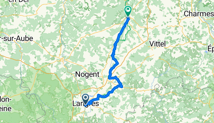
Langres nach Neufchateau
A cycling route starting in Langres, Grand Est, France.
Overview
About this route
- 9 h 57 min
- Duration
- 95.6 km
- Distance
- 697 m
- Ascent
- 877 m
- Descent
- 9.6 km/h
- Avg. speed
- 470 m
- Max. altitude

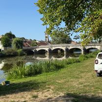
Route photos


Route quality
Waytypes & surfaces along the route
Waytypes
Road
41.1 km
(43 %)
Quiet road
14.3 km
(15 %)
Surfaces
Paved
55.4 km
(58 %)
Unpaved
1 km
(1 %)
Asphalt
55.4 km
(58 %)
Gravel
1 km
(1 %)
Undefined
39.2 km
(41 %)
Continue with Bikemap
Use, edit, or download this cycling route
You would like to ride Langres nach Neufchateau or customize it for your own trip? Here is what you can do with this Bikemap route:
Free features
- Save this route as favorite or in collections
- Copy & plan your own version of this route
- Split it into stages to create a multi-day tour
- Sync your route with Garmin or Wahoo
Premium features
Free trial for 3 days, or one-time payment. More about Bikemap Premium.
- Navigate this route on iOS & Android
- Export a GPX / KML file of this route
- Create your custom printout (try it for free)
- Download this route for offline navigation
Discover more Premium features.
Get Bikemap PremiumFrom our community
Other popular routes starting in Langres
 Langres nach Neufchateau
- Distance
- 95.6 km
- Ascent
- 697 m
- Descent
- 877 m
- Location
- Langres, Grand Est, France
 Aadorf - Paris 6. Tag Langres - Vouécourt sur la Marne
- Distance
- 62.9 km
- Ascent
- 90 m
- Descent
- 323 m
- Location
- Langres, Grand Est, France
 2 Langres to Montelimar via Calon sur Saone, Macon, Lyon, Vienne & Valence
- Distance
- 525 km
- Ascent
- 154 m
- Descent
- 532 m
- Location
- Langres, Grand Est, France
 Langres - Chevillard (3j)
- Distance
- 252.7 km
- Ascent
- 1,247 m
- Descent
- 896 m
- Location
- Langres, Grand Est, France
 Toul Le-Puy Etappe 3 Langres - Dijon CLONED FROM ROUTE 792483
- Distance
- 88.4 km
- Ascent
- 480 m
- Descent
- 701 m
- Location
- Langres, Grand Est, France
 Etape 6 / St geosmes _ Vesoul
- Distance
- 82.8 km
- Ascent
- 437 m
- Descent
- 738 m
- Location
- Langres, Grand Est, France
 J3A REC2MIPIM 2018
- Distance
- 58.1 km
- Ascent
- 158 m
- Descent
- 385 m
- Location
- Langres, Grand Est, France
 Parcours route Ross/Jojo 30/04/2016
- Distance
- 57.2 km
- Ascent
- 586 m
- Descent
- 584 m
- Location
- Langres, Grand Est, France
Open it in the app