
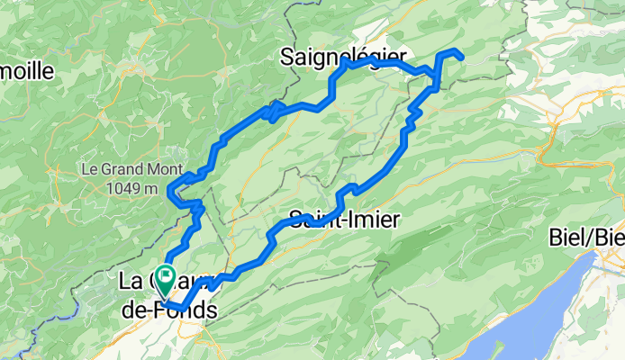
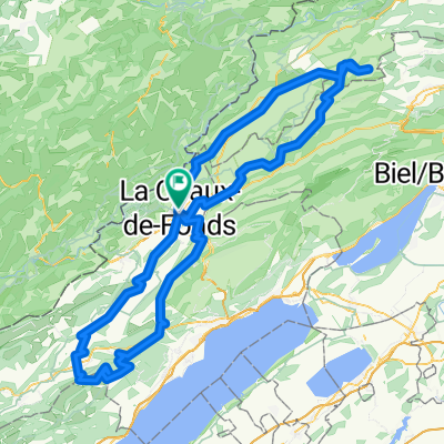
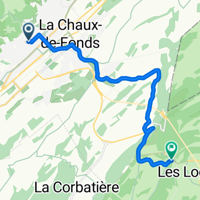
Route in La Chaux-de-Fonds
A cycling route starting in La Chaux-de-Fonds, Canton of Neuchâtel, Switzerland.
Overview
About this route
- 7 h 14 min
- Duration
- 90.8 km
- Distance
- 2,563 m
- Ascent
- 2,565 m
- Descent
- 12.6 km/h
- Avg. speed
- 1,280 m
- Max. altitude
Route quality
Waytypes & surfaces along the route
Waytypes
Quiet road
59 km
(65 %)
Track
17.3 km
(19 %)
Surfaces
Paved
48.1 km
(53 %)
Unpaved
9.1 km
(10 %)
Asphalt
27.2 km
(30 %)
Paved (undefined)
20.9 km
(23 %)
Continue with Bikemap
Use, edit, or download this cycling route
You would like to ride Route in La Chaux-de-Fonds or customize it for your own trip? Here is what you can do with this Bikemap route:
Free features
- Save this route as favorite or in collections
- Copy & plan your own version of this route
- Split it into stages to create a multi-day tour
- Sync your route with Garmin or Wahoo
Premium features
Free trial for 3 days, or one-time payment. More about Bikemap Premium.
- Navigate this route on iOS & Android
- Export a GPX / KML file of this route
- Create your custom printout (try it for free)
- Download this route for offline navigation
Discover more Premium features.
Get Bikemap PremiumFrom our community
Other popular routes starting in La Chaux-de-Fonds
 la Ferrière
- Distance
- 28.7 km
- Ascent
- 519 m
- Descent
- 515 m
- Location
- La Chaux-de-Fonds, Canton of Neuchâtel, Switzerland
 2021 La Chaux-de-Fonds - Porrentruy
- Distance
- 312 km
- Ascent
- 495 m
- Descent
- 1,070 m
- Location
- La Chaux-de-Fonds, Canton of Neuchâtel, Switzerland
 La Chaux-de-Fonds - Tête-de-Ran
- Distance
- 19.5 km
- Ascent
- 597 m
- Descent
- 597 m
- Location
- La Chaux-de-Fonds, Canton of Neuchâtel, Switzerland
 petite tour du matin
- Distance
- 30.7 km
- Ascent
- 1,163 m
- Descent
- 1,156 m
- Location
- La Chaux-de-Fonds, Canton of Neuchâtel, Switzerland
 La Chaux-de-Fonds -Creux du VAn
- Distance
- 156.3 km
- Ascent
- 3,940 m
- Descent
- 3,940 m
- Location
- La Chaux-de-Fonds, Canton of Neuchâtel, Switzerland
 La Chaux-de-Fonds to Porrentruy
- Distance
- 81.2 km
- Ascent
- 1,431 m
- Descent
- 1,997 m
- Location
- La Chaux-de-Fonds, Canton of Neuchâtel, Switzerland
 La Chaux-de-Fonds - St Croix
- Distance
- 111.5 km
- Ascent
- 1,316 m
- Descent
- 1,316 m
- Location
- La Chaux-de-Fonds, Canton of Neuchâtel, Switzerland
 De Rue Combe-Grieurin à Route de la Vue-des-Alpes
- Distance
- 9 km
- Ascent
- 348 m
- Descent
- 116 m
- Location
- La Chaux-de-Fonds, Canton of Neuchâtel, Switzerland
Open it in the app