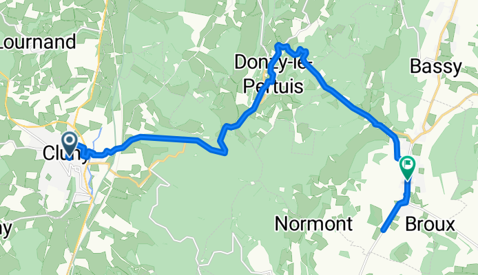
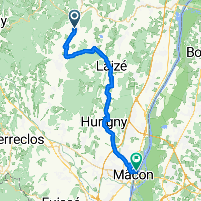
Mâcon - Voie Verte - Cluny - Donzy - Azé - Hurigny - Mâcon
Cluny - Cluny
A cycling route starting in Cluny, Bourgogne-Franche-Comté, France.
Overview
About this route
- 1 h
- Duration
- 15.7 km
- Distance
- 377 m
- Ascent
- 388 m
- Descent
- 15.7 km/h
- Avg. speed
- 493 m
- Max. altitude
Part of
Route quality
Waytypes & surfaces along the route
Waytypes
Quiet road
4.9 km
(31 %)
Road
3.1 km
(20 %)
Surfaces
Paved
3.4 km
(22 %)
Unpaved
0.2 km
(1 %)
Asphalt
3.4 km
(22 %)
Ground
0.2 km
(1 %)
Undefined
12.1 km
(77 %)
Continue with Bikemap
Use, edit, or download this cycling route
You would like to ride Cluny - Cluny or customize it for your own trip? Here is what you can do with this Bikemap route:
Free features
- Save this route as favorite or in collections
- Copy & plan your own version of this route
- Sync your route with Garmin or Wahoo
Premium features
Free trial for 3 days, or one-time payment. More about Bikemap Premium.
- Navigate this route on iOS & Android
- Export a GPX / KML file of this route
- Create your custom printout (try it for free)
- Download this route for offline navigation
Discover more Premium features.
Get Bikemap PremiumFrom our community
Other popular routes starting in Cluny
Scey-sur-SaĂ´ne-et-Saint-Albin - Chalon-sur-SaĂ´ne- Distance
- 43 km
- Ascent
- 210 m
- Descent
- 271 m
- Location
- Cluny, Bourgogne-Franche-Comté, France
Route nach Rathenow- Distance
- 1,288.3 km
- Ascent
- 6,314 m
- Descent
- 6,523 m
- Location
- Cluny, Bourgogne-Franche-Comté, France
Tour de bourgogne du Sud #2- Distance
- 38.9 km
- Ascent
- 433 m
- Descent
- 599 m
- Location
- Cluny, Bourgogne-Franche-Comté, France
Taize - Chalon-sur-Saone- Distance
- 46 km
- Ascent
- 198 m
- Descent
- 263 m
- Location
- Cluny, Bourgogne-Franche-Comté, France
Von Cluny bis La Mulatière- Distance
- 109.4 km
- Ascent
- 529 m
- Descent
- 602 m
- Location
- Cluny, Bourgogne-Franche-Comté, France
Cluny - Saint-Laurent-sur-SaĂ´ne- Distance
- 22.4 km
- Ascent
- 212 m
- Descent
- 267 m
- Location
- Cluny, Bourgogne-Franche-Comté, France
Saint-Éloy-les-Mines - Cluny- Distance
- 236.1 km
- Ascent
- 2,425 m
- Descent
- 2,309 m
- Location
- Cluny, Bourgogne-Franche-Comté, France
Reign 1- Distance
- 20 km
- Ascent
- 578 m
- Descent
- 581 m
- Location
- Cluny, Bourgogne-Franche-Comté, France
Open it in the app


