

Von Ebersbach an den Herrenbachstausee
A cycling route starting in Ebersbach an der Fils, Baden-Wurttemberg, Germany.
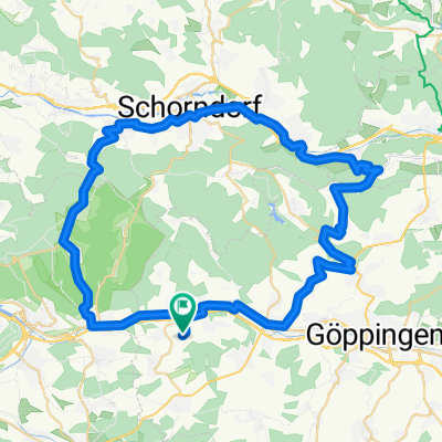
Overview
About this route
Beautiful mountain route with approximately 450 m of elevation gain and some nice forest paths. Duration of the ride is about 2.5 hours.
- -:--
- Duration
- 25.3 km
- Distance
- 570 m
- Ascent
- 479 m
- Descent
- ---
- Avg. speed
- 483 m
- Max. altitude
Route quality
Waytypes & surfaces along the route
Waytypes
Track
18.7 km
(74 %)
Quiet road
3.8 km
(15 %)
Surfaces
Paved
4.5 km
(18 %)
Unpaved
20 km
(79 %)
Gravel
18.4 km
(73 %)
Asphalt
4.3 km
(17 %)
Continue with Bikemap
Use, edit, or download this cycling route
You would like to ride Von Ebersbach an den Herrenbachstausee or customize it for your own trip? Here is what you can do with this Bikemap route:
Free features
- Save this route as favorite or in collections
- Copy & plan your own version of this route
- Sync your route with Garmin or Wahoo
Premium features
Free trial for 3 days, or one-time payment. More about Bikemap Premium.
- Navigate this route on iOS & Android
- Export a GPX / KML file of this route
- Create your custom printout (try it for free)
- Download this route for offline navigation
Discover more Premium features.
Get Bikemap PremiumFrom our community
Other popular routes starting in Ebersbach an der Fils
 Sulpach-Randecker Maar- Bad Urach-Falkensteiner Höhle- Deutsches Haus-Sulpach
- Distance
- 88.9 km
- Ascent
- 1,791 m
- Descent
- 1,735 m
- Location
- Ebersbach an der Fils, Baden-Wurttemberg, Germany
 Sulpach-Eselhöfe-Sulpach: Große Runde
- Distance
- 99.7 km
- Ascent
- 2,020 m
- Descent
- 1,980 m
- Location
- Ebersbach an der Fils, Baden-Wurttemberg, Germany
 Sulpach- Börtlingen-Waldhausen-Winterbach-Baltmannsweiler-Sulpach
- Distance
- 59.3 km
- Ascent
- 676 m
- Descent
- 664 m
- Location
- Ebersbach an der Fils, Baden-Wurttemberg, Germany
 Sulpach-Boll-Weilheim-Kirchhm-Plochingen-Slpch
- Distance
- 53.8 km
- Ascent
- 363 m
- Descent
- 418 m
- Location
- Ebersbach an der Fils, Baden-Wurttemberg, Germany
 Sulpach- Wendlingen-Nürtingen-Ötlingen-Hochdorf-Sulpach
- Distance
- 45.1 km
- Ascent
- 254 m
- Descent
- 288 m
- Location
- Ebersbach an der Fils, Baden-Wurttemberg, Germany
 Sulpach-Hepsisau-Bad Urach-Dettingen/Erms-Kirchheim-Sulpach
- Distance
- 98.4 km
- Ascent
- 1,464 m
- Descent
- 1,523 m
- Location
- Ebersbach an der Fils, Baden-Wurttemberg, Germany
 Von Ebersbach an den Herrenbachstausee
- Distance
- 25.3 km
- Ascent
- 570 m
- Descent
- 479 m
- Location
- Ebersbach an der Fils, Baden-Wurttemberg, Germany
 Große Albrunde (Westerheim - Heubach - Donnstetten)
- Distance
- 114.6 km
- Ascent
- 1,625 m
- Descent
- 1,516 m
- Location
- Ebersbach an der Fils, Baden-Wurttemberg, Germany
Open it in the app