
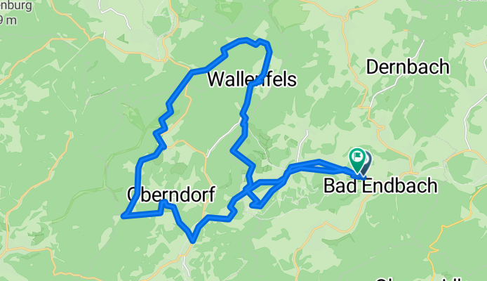
Bad Enbach, Wilhelmssteine, Oberndorf,Bad Enbach
A cycling route starting in Bad Endbach, Hesse, Germany.
Overview
About this route
Strecke ist interessant, weil viel im Wald gefahren wird. Außerdem hat man sehr schöne Aussichtspunkte zum Genießen.
- -:--
- Duration
- 27.2 km
- Distance
- 466 m
- Ascent
- 457 m
- Descent
- ---
- Avg. speed
- ---
- Avg. speed
Route quality
Waytypes & surfaces along the route
Waytypes
Track
11.5 km
(42 %)
Busy road
8 km
(30 %)
Surfaces
Paved
16.7 km
(62 %)
Unpaved
9.4 km
(35 %)
Asphalt
16 km
(59 %)
Gravel
4.9 km
(18 %)
Continue with Bikemap
Use, edit, or download this cycling route
You would like to ride Bad Enbach, Wilhelmssteine, Oberndorf,Bad Enbach or customize it for your own trip? Here is what you can do with this Bikemap route:
Free features
- Save this route as favorite or in collections
- Copy & plan your own version of this route
- Sync your route with Garmin or Wahoo
Premium features
Free trial for 3 days, or one-time payment. More about Bikemap Premium.
- Navigate this route on iOS & Android
- Export a GPX / KML file of this route
- Create your custom printout (try it for free)
- Download this route for offline navigation
Discover more Premium features.
Get Bikemap PremiumFrom our community
Other popular routes starting in Bad Endbach
 große Feierabendrunde
- Distance
- 58.4 km
- Ascent
- 285 m
- Descent
- 285 m
- Location
- Bad Endbach, Hesse, Germany
 RW02-Günterod_43km
- Distance
- 43.4 km
- Ascent
- 364 m
- Descent
- 364 m
- Location
- Bad Endbach, Hesse, Germany
 Schloß Biedenkopf - Sackpfeife und zurück
- Distance
- 72.5 km
- Ascent
- 977 m
- Descent
- 978 m
- Location
- Bad Endbach, Hesse, Germany
 Am Heiligen Stock 14, Bad Endbach nach Hauptstraße 90A, Bad Endbach
- Distance
- 22.4 km
- Ascent
- 503 m
- Descent
- 523 m
- Location
- Bad Endbach, Hesse, Germany
 RW01-Günterod_27km
- Distance
- 25.2 km
- Ascent
- 433 m
- Descent
- 432 m
- Location
- Bad Endbach, Hesse, Germany
 FLOWTRAIL TOUR
- Distance
- 12.1 km
- Ascent
- 296 m
- Descent
- 222 m
- Location
- Bad Endbach, Hesse, Germany
 Karl
Karl- Distance
- 34.7 km
- Ascent
- 101 m
- Descent
- 314 m
- Location
- Bad Endbach, Hesse, Germany
 RW03-Günterod_20
- Distance
- 20.2 km
- Ascent
- 294 m
- Descent
- 294 m
- Location
- Bad Endbach, Hesse, Germany
Open it in the app