
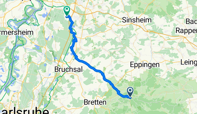
49.051, 8.851 nach 49.266, 8.590
A cycling route starting in Sternenfels, Baden-Wurttemberg, Germany.
Overview
About this route
- 2 h 21 min
- Duration
- 41.9 km
- Distance
- 84 m
- Ascent
- 289 m
- Descent
- 17.9 km/h
- Avg. speed
- 320 m
- Max. altitude

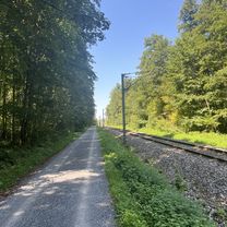
Route photos


Route quality
Waytypes & surfaces along the route
Waytypes
Quiet road
11.3 km
(27 %)
Path
9.6 km
(23 %)
Surfaces
Paved
31 km
(74 %)
Unpaved
2.9 km
(7 %)
Asphalt
28.9 km
(69 %)
Paved (undefined)
2.1 km
(5 %)
Continue with Bikemap
Use, edit, or download this cycling route
You would like to ride 49.051, 8.851 nach 49.266, 8.590 or customize it for your own trip? Here is what you can do with this Bikemap route:
Free features
- Save this route as favorite or in collections
- Copy & plan your own version of this route
- Sync your route with Garmin or Wahoo
Premium features
Free trial for 3 days, or one-time payment. More about Bikemap Premium.
- Navigate this route on iOS & Android
- Export a GPX / KML file of this route
- Create your custom printout (try it for free)
- Download this route for offline navigation
Discover more Premium features.
Get Bikemap PremiumFrom our community
Other popular routes starting in Sternenfels
 220616 Strombergrunde
- Distance
- 68.5 km
- Ascent
- 723 m
- Descent
- 720 m
- Location
- Sternenfels, Baden-Wurttemberg, Germany
 49.051, 8.851 nach 49.266, 8.590
- Distance
- 41.9 km
- Ascent
- 84 m
- Descent
- 289 m
- Location
- Sternenfels, Baden-Wurttemberg, Germany
 Kraichradweg
- Distance
- 63.3 km
- Ascent
- 175 m
- Descent
- 379 m
- Location
- Sternenfels, Baden-Wurttemberg, Germany
 Sternefels
- Distance
- 52.8 km
- Ascent
- 476 m
- Descent
- 476 m
- Location
- Sternenfels, Baden-Wurttemberg, Germany
 Zabergäu
- Distance
- 33.2 km
- Ascent
- 549 m
- Descent
- 549 m
- Location
- Sternenfels, Baden-Wurttemberg, Germany
 Liam tour
- Distance
- 9.6 km
- Ascent
- 201 m
- Descent
- 188 m
- Location
- Sternenfels, Baden-Wurttemberg, Germany
 Strombergc.-St.Leon Roth-Weiler-Eppingen
- Distance
- 82.4 km
- Ascent
- 611 m
- Descent
- 730 m
- Location
- Sternenfels, Baden-Wurttemberg, Germany
 Heuchelberger Warthe
- Distance
- 69.7 km
- Ascent
- 944 m
- Descent
- 933 m
- Location
- Sternenfels, Baden-Wurttemberg, Germany
Open it in the app