
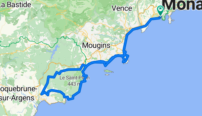
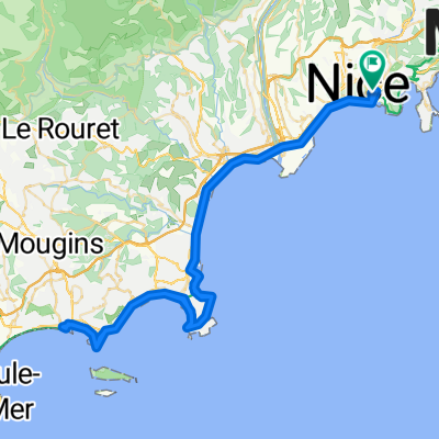
Start of Esterel - Tanneron - Esterel - Tanneron - Copenhagen Coffee Lab - Cagnes Sur Mer - Copenhagen Coffee Lab - Cagnes Sur Mer - Boulangerie De L'ilette ...
A cycling route starting in Nice, Provence-Alpes-Côte d'Azur Region, France.
Overview
About this route
Elevation: 1 m - Statistics computed from imported dataDistance: 154.3 kmMinimum Elevation: -0 mMaximum Elevation: 326 mTotal climb: 907 mTotal descent: 906 m - -
- 10 h 51 min
- Duration
- 156.7 km
- Distance
- 2,450 m
- Ascent
- 2,451 m
- Descent
- 14.4 km/h
- Avg. speed
- 353 m
- Max. altitude
Continue with Bikemap
Use, edit, or download this cycling route
You would like to ride Start of Esterel - Tanneron - Esterel - Tanneron - Copenhagen Coffee Lab - Cagnes Sur Mer - Copenhagen Coffee Lab - Cagnes Sur Mer - Boulangerie De L'ilette ... or customize it for your own trip? Here is what you can do with this Bikemap route:
Free features
- Save this route as favorite or in collections
- Copy & plan your own version of this route
- Split it into stages to create a multi-day tour
- Sync your route with Garmin or Wahoo
Premium features
Free trial for 3 days, or one-time payment. More about Bikemap Premium.
- Navigate this route on iOS & Android
- Export a GPX / KML file of this route
- Create your custom printout (try it for free)
- Download this route for offline navigation
Discover more Premium features.
Get Bikemap PremiumFrom our community
Other popular routes starting in Nice
 202507 Nizza nach Genua
- Distance
- 308 km
- Ascent
- 3,682 m
- Descent
- 3,673 m
- Location
- Nice, Provence-Alpes-Côte d'Azur Region, France
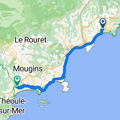 Nice - Cannes
- Distance
- 42.6 km
- Ascent
- 466 m
- Descent
- 473 m
- Location
- Nice, Provence-Alpes-Côte d'Azur Region, France
 Col de la Madone 74km
- Distance
- 72.6 km
- Ascent
- 1,515 m
- Descent
- 1,516 m
- Location
- Nice, Provence-Alpes-Côte d'Azur Region, France
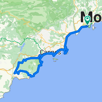 Start of Esterel - Tanneron - Esterel - Tanneron - Copenhagen Coffee Lab - Cagnes Sur Mer - Copenhagen Coffee Lab - Cagnes Sur Mer - Boulangerie De L'ilette ...
- Distance
- 156.7 km
- Ascent
- 2,450 m
- Descent
- 2,451 m
- Location
- Nice, Provence-Alpes-Côte d'Azur Region, France
 10 Impasse Des Noisetiers
- Distance
- 7.4 km
- Ascent
- 94 m
- Descent
- 58 m
- Location
- Nice, Provence-Alpes-Côte d'Azur Region, France
 Tour du Mont BORON par la moyenne corniche
- Distance
- 24.5 km
- Ascent
- 336 m
- Descent
- 406 m
- Location
- Nice, Provence-Alpes-Côte d'Azur Region, France
 fatto_Nice to Cannes
- Distance
- 88.1 km
- Ascent
- 486 m
- Descent
- 486 m
- Location
- Nice, Provence-Alpes-Côte d'Azur Region, France
 Von Nizza bis Grasse und zurück
- Distance
- 80.1 km
- Ascent
- 1,234 m
- Descent
- 1,243 m
- Location
- Nice, Provence-Alpes-Côte d'Azur Region, France
Open it in the app