- 6.8 km
- 10 m
- 63 m
- Sulzbach, Hesse, Germany
TriKids SG Nied 2012 Jahrg.1999/2000 - 8,1km
A cycling route starting in Sulzbach, Hesse, Germany.
Overview
About this route
Die Alternative Radstrecke des TriKids 2012 Jahrgang 1
ACHTUNG:
Der Mittelteil der Radstrecke wird dieses Jahr ZWEIMAL gefahren!
Beim Überqueren der Niddabrücke MUSS kurz vom Rad abgestiegen werden!
- -:--
- Duration
- 8.1 km
- Distance
- 9 m
- Ascent
- 9 m
- Descent
- ---
- Avg. speed
- ---
- Max. altitude
created this 13 years ago
Route highlights
Points of interest along the route
Point of interest after 0 km
Schwimmbad
Point of interest after 0 km
Wechselzone 1
Point of interest after 0 km
Anmeldung / CheckIn
Point of interest after 3.8 km
Ab hier 2. Runde fahren !
Point of interest after 7.4 km
Nach 2. Runde, hier absteigen und über Brücke schieben!
Point of interest after 8.1 km
Laufstrecke
Point of interest after 8.1 km
Wechselzone 2
Point of interest after 8.1 km
Ziel
Point of interest after 8.1 km
Parken
Continue with Bikemap
Use, edit, or download this cycling route
You would like to ride TriKids SG Nied 2012 Jahrg.1999/2000 - 8,1km or customize it for your own trip? Here is what you can do with this Bikemap route:
Free features
- Save this route as favorite or in collections
- Copy & plan your own version of this route
- Sync your route with Garmin or Wahoo
Premium features
Free trial for 3 days, or one-time payment. More about Bikemap Premium.
- Navigate this route on iOS & Android
- Export a GPX / KML file of this route
- Create your custom printout (try it for free)
- Download this route for offline navigation
Discover more Premium features.
Get Bikemap PremiumFrom our community
Other popular routes starting in Sulzbach
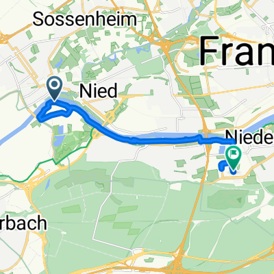
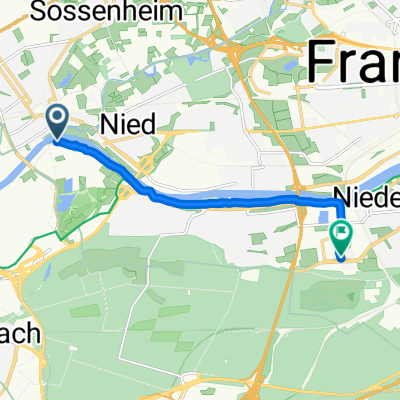
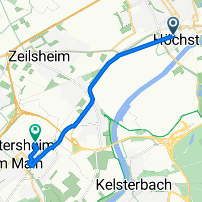
- Albanusstraße nach Liederbacher Straße
- Burggraben, Frankfurt am Main nach Lyoner Straße 52G, Frankfurt am Main
- 8.8 km
- 397 m
- 390 m
- Sulzbach, Hesse, Germany
- Höchster Weg, Frankfurt am Main nach Lyoner Straße, Frankfurt am Main
- 11.3 km
- 439 m
- 436 m
- Sulzbach, Hesse, Germany
- Trainingsrunde Feldberg von hinten
- 77.3 km
- 1,415 m
- 1,263 m
- Sulzbach, Hesse, Germany
- Höchster Weg, Frankfurt am Main nach Lyoner Straße, Frankfurt am Main
- 7.7 km
- 241 m
- 233 m
- Sulzbach, Hesse, Germany
- Frankfurt Höchst - Grüngürtel
- 61.8 km
- 366 m
- 363 m
- Sulzbach, Hesse, Germany
- Frankfurt Hoechst - Sachsenhausen - City - Runde
- 29.3 km
- 179 m
- 177 m
- Sulzbach, Hesse, Germany
- Höchster Weg, Frankfurt am Main nach Lyoner Straße, Frankfurt am Main
- 7.5 km
- 279 m
- 278 m
- Sulzbach, Hesse, Germany
Open it in the app


