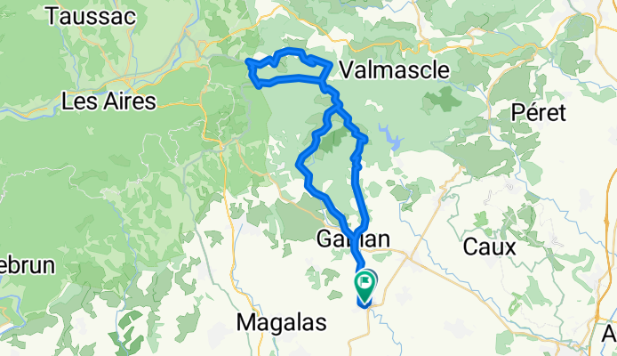
Place de l'Étoile naar Place de l'Étoile
A cycling route starting in Roujan, Occitanie, France.
Overview
About this route
- 3 h 23 min
- Duration
- 47.1 km
- Distance
- 822 m
- Ascent
- 873 m
- Descent
- 13.9 km/h
- Avg. speed
- 391 m
- Max. altitude
Route photos
Route quality
Waytypes & surfaces along the route
Waytypes
Road
42.5 km
(90 %)
Quiet road
4.1 km
(9 %)
Continue with Bikemap
Use, edit, or download this cycling route
You would like to ride Place de l'Étoile naar Place de l'Étoile or customize it for your own trip? Here is what you can do with this Bikemap route:
Free features
- Save this route as favorite or in collections
- Copy & plan your own version of this route
- Sync your route with Garmin or Wahoo
Premium features
Free trial for 3 days, or one-time payment. More about Bikemap Premium.
- Navigate this route on iOS & Android
- Export a GPX / KML file of this route
- Create your custom printout (try it for free)
- Download this route for offline navigation
Discover more Premium features.
Get Bikemap PremiumFrom our community
Other popular routes starting in Roujan
- Rue du Clédat naar Place de l'Étoile
- Distance
- 48.8 km
- Ascent
- 801 m
- Descent
- 840 m
- Location
- Roujan, Occitanie, France
- 2020 Runde um Vailhan Stausee
- Distance
- 16.3 km
- Ascent
- 301 m
- Descent
- 303 m
- Location
- Roujan, Occitanie, France
- ride to Pézenas
- Distance
- 15.3 km
- Ascent
- 81 m
- Descent
- 138 m
- Location
- Roujan, Occitanie, France
- Place de l'Étoile naar Place de l'Étoile
- Distance
- 47.1 km
- Ascent
- 822 m
- Descent
- 873 m
- Location
- Roujan, Occitanie, France
- gollu budist rota
- Distance
- 136 km
- Ascent
- 1,738 m
- Descent
- 1,745 m
- Location
- Roujan, Occitanie, France
- Rue du Clédat naar Place de l'Étoile
- Distance
- 41 km
- Ascent
- 547 m
- Descent
- 595 m
- Location
- Roujan, Occitanie, France
- 2020 Les Montades Eglise Tour
- Distance
- 6.9 km
- Ascent
- 168 m
- Descent
- 170 m
- Location
- Roujan, Occitanie, France
- 2020 Valmascle-Les Montades Runde
- Distance
- 16.9 km
- Ascent
- 337 m
- Descent
- 338 m
- Location
- Roujan, Occitanie, France
Open it in the app