
Von Köln bis Langenargen
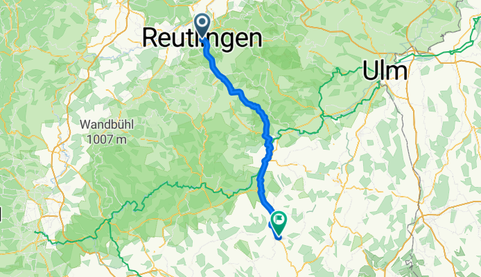
Schönaich - Hayingen
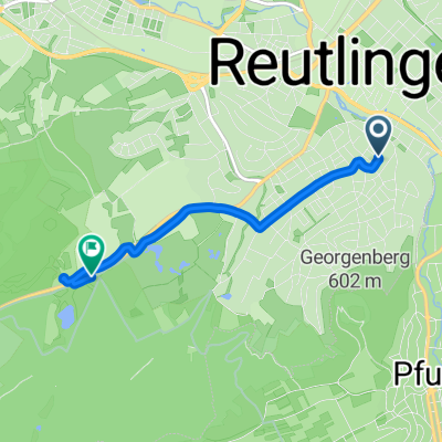
A cycling route starting in Reutlingen, Baden-Wurttemberg, Germany.
Overview
About this route
- 4 h 58 min
- Duration
- 87 km
- Distance
- 1,073 m
- Ascent
- 871 m
- Descent
- 17.6 km/h
- Avg. speed
- 793 m
- Max. altitude

Part of
Von Köln bis Langenargen
7 stages
Route quality
Waytypes & surfaces along the route
Waytypes
Track
31.3 km
(36 %)
Quiet road
30.5 km
(35 %)
Surfaces
Paved
75.7 km
(87 %)
Unpaved
2.6 km
(3 %)
Asphalt
74 km
(85 %)
Gravel
2.6 km
(3 %)
Continue with Bikemap
Use, edit, or download this cycling route
You would like to ride Schönaich - Hayingen or customize it for your own trip? Here is what you can do with this Bikemap route:
Free features
- Save this route as favorite or in collections
- Copy & plan your own version of this route
- Split it into stages to create a multi-day tour
- Sync your route with Garmin or Wahoo
Premium features
Free trial for 3 days, or one-time payment. More about Bikemap Premium.
- Navigate this route on iOS & Android
- Export a GPX / KML file of this route
- Create your custom printout (try it for free)
- Download this route for offline navigation
Discover more Premium features.
Get Bikemap PremiumFrom our community
Other popular routes starting in Reutlingen
 Holzgerlingen - Ebersbach an der Fils
- Distance
- 48.4 km
- Ascent
- 594 m
- Descent
- 684 m
- Location
- Reutlingen, Baden-Wurttemberg, Germany
 Reutlingen Nürtingen Wendlingen 32km 110hm
- Distance
- 32.4 km
- Ascent
- 90 m
- Descent
- 217 m
- Location
- Reutlingen, Baden-Wurttemberg, Germany
 Von Betzingen nach Iznang 08/25
- Distance
- 124.7 km
- Ascent
- 1,756 m
- Descent
- 1,744 m
- Location
- Reutlingen, Baden-Wurttemberg, Germany
 Schönaich - Hayingen
- Distance
- 87 km
- Ascent
- 1,073 m
- Descent
- 871 m
- Location
- Reutlingen, Baden-Wurttemberg, Germany
 Schloss Lichtenstein Tour
- Distance
- 32.1 km
- Ascent
- 468 m
- Descent
- 468 m
- Location
- Reutlingen, Baden-Wurttemberg, Germany
 Steinenbergstraße, Reutlingen nach Schlattwiesenstraße, Reutlingen
- Distance
- 4.4 km
- Ascent
- 47 m
- Descent
- 41 m
- Location
- Reutlingen, Baden-Wurttemberg, Germany
 Lautertal
- Distance
- 75.8 km
- Ascent
- 952 m
- Descent
- 945 m
- Location
- Reutlingen, Baden-Wurttemberg, Germany
 Von Reutlingen bis Langwedel
- Distance
- 690.7 km
- Ascent
- 4,721 m
- Descent
- 5,092 m
- Location
- Reutlingen, Baden-Wurttemberg, Germany
Open it in the app