
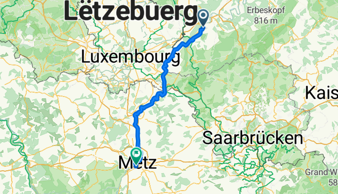
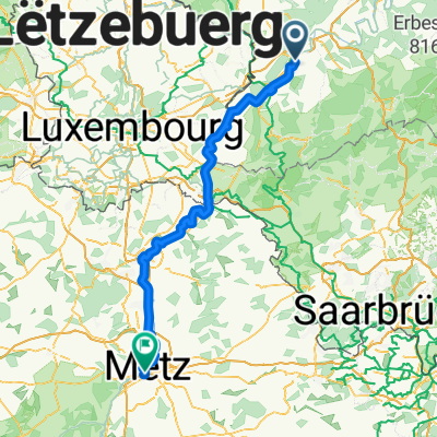
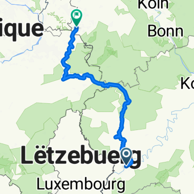
14.0_ Trier bis Metz
A cycling route starting in Trier, Rhineland-Palatinate, Germany.
Overview
About this route
- 6 h 57 min
- Duration
- 117.6 km
- Distance
- 721 m
- Ascent
- 683 m
- Descent
- 16.9 km/h
- Avg. speed
- 343 m
- Max. altitude
Route quality
Waytypes & surfaces along the route
Waytypes
Path
52.9 km
(45 %)
Access road
24.7 km
(21 %)
Surfaces
Paved
105.8 km
(90 %)
Unpaved
1.2 km
(1 %)
Asphalt
87 km
(74 %)
Paved (undefined)
12.9 km
(11 %)
Continue with Bikemap
Use, edit, or download this cycling route
You would like to ride 14.0_ Trier bis Metz or customize it for your own trip? Here is what you can do with this Bikemap route:
Free features
- Save this route as favorite or in collections
- Copy & plan your own version of this route
- Split it into stages to create a multi-day tour
- Sync your route with Garmin or Wahoo
Premium features
Free trial for 3 days, or one-time payment. More about Bikemap Premium.
- Navigate this route on iOS & Android
- Export a GPX / KML file of this route
- Create your custom printout (try it for free)
- Download this route for offline navigation
Discover more Premium features.
Get Bikemap PremiumFrom our community
Other popular routes starting in Trier
 Route in Trier
- Distance
- 36 km
- Ascent
- 927 m
- Descent
- 928 m
- Location
- Trier, Rhineland-Palatinate, Germany
 Trier - Merzig
- Distance
- 57.3 km
- Ascent
- 324 m
- Descent
- 291 m
- Location
- Trier, Rhineland-Palatinate, Germany
 Route in Trier
- Distance
- 68.8 km
- Ascent
- 1,264 m
- Descent
- 1,268 m
- Location
- Trier, Rhineland-Palatinate, Germany
 14.0_ Trier bis Metz
- Distance
- 117.6 km
- Ascent
- 721 m
- Descent
- 683 m
- Location
- Trier, Rhineland-Palatinate, Germany
 Kenn - Mehren
- Distance
- 78.8 km
- Ascent
- 925 m
- Descent
- 620 m
- Location
- Trier, Rhineland-Palatinate, Germany
 Trier Stadtrunde
- Distance
- 8 km
- Ascent
- 28 m
- Descent
- 29 m
- Location
- Trier, Rhineland-Palatinate, Germany
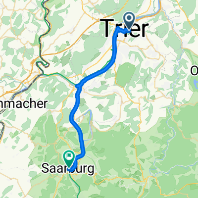 2. Etappe - Graf-Siegfried-Straße, Saarburg nach Heinertstraße, Mettlach
- Distance
- 24.3 km
- Ascent
- 166 m
- Descent
- 139 m
- Location
- Trier, Rhineland-Palatinate, Germany
 Bahnhofsplatz nach Domhof
- Distance
- 231.7 km
- Ascent
- 3,744 m
- Descent
- 3,707 m
- Location
- Trier, Rhineland-Palatinate, Germany
Open it in the app