
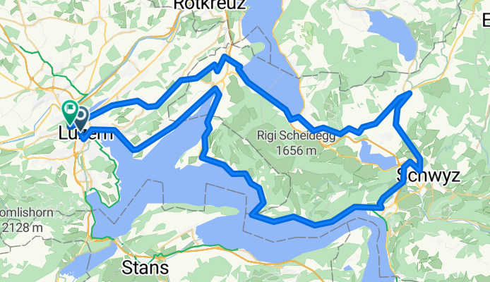
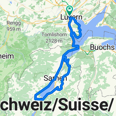
Um die Rigi, inkl. Sattel
A cycling route starting in Lucerne, Canton of Lucerne, Switzerland.
Overview
About this route
- 4 h 56 min
- Duration
- 89.3 km
- Distance
- 1,759 m
- Ascent
- 1,752 m
- Descent
- 18.1 km/h
- Avg. speed
- 781 m
- Max. altitude

Route quality
Waytypes & surfaces along the route
Waytypes
Quiet road
15.2 km
(17 %)
Road
5.4 km
(6 %)
Surfaces
Paved
64.3 km
(72 %)
Asphalt
61.6 km
(69 %)
Paved (undefined)
2.7 km
(3 %)
Undefined
25 km
(28 %)
Continue with Bikemap
Use, edit, or download this cycling route
You would like to ride Um die Rigi, inkl. Sattel or customize it for your own trip? Here is what you can do with this Bikemap route:
Free features
- Save this route as favorite or in collections
- Copy & plan your own version of this route
- Split it into stages to create a multi-day tour
- Sync your route with Garmin or Wahoo
Premium features
Free trial for 3 days, or one-time payment. More about Bikemap Premium.
- Navigate this route on iOS & Android
- Export a GPX / KML file of this route
- Create your custom printout (try it for free)
- Download this route for offline navigation
Discover more Premium features.
Get Bikemap PremiumFrom our community
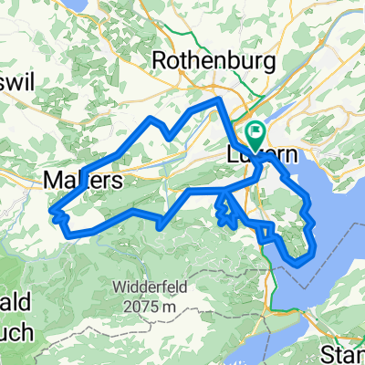
Other popular routes starting in Lucerne
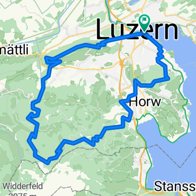
 Luzern-fräkmunt-alpgschwend-hergiswil-buchrain
- Distance
- 43.6 km
- Ascent
- 1,115 m
- Descent
- 1,128 m
- Location
- Lucerne, Canton of Lucerne, Switzerland
 Fräki
Fräki- Distance
- 32 km
- Ascent
- 1,247 m
- Descent
- 1,245 m
- Location
- Lucerne, Canton of Lucerne, Switzerland
 Ufe um Luzern
- Distance
- 57.9 km
- Ascent
- 1,294 m
- Descent
- 1,296 m
- Location
- Lucerne, Canton of Lucerne, Switzerland
 Trüllhofstrasse to Schützengasse
- Distance
- 71.5 km
- Ascent
- 610 m
- Descent
- 635 m
- Location
- Lucerne, Canton of Lucerne, Switzerland
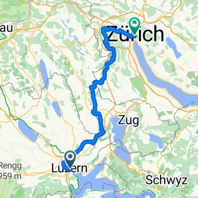
 Klausenpass
- Distance
- 101 km
- Ascent
- 1,731 m
- Descent
- 1,729 m
- Location
- Lucerne, Canton of Lucerne, Switzerland
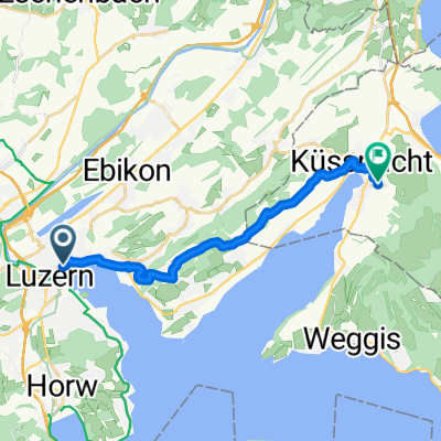 Von Küssnacht (Schwyz) bis Luzern
- Distance
- 14.5 km
- Ascent
- 373 m
- Descent
- 269 m
- Location
- Lucerne, Canton of Lucerne, Switzerland
 Sarnen flach
- Distance
- 79 km
- Ascent
- 1,498 m
- Descent
- 1,497 m
- Location
- Lucerne, Canton of Lucerne, Switzerland
 Ufe um Luzern - Variante Chestenebaum
- Distance
- 70.5 km
- Ascent
- 1,396 m
- Descent
- 1,396 m
- Location
- Lucerne, Canton of Lucerne, Switzerland
Open it in the app