
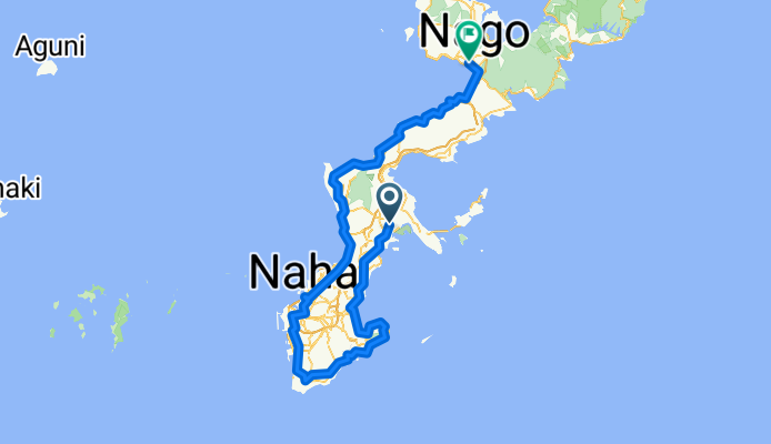
Overview
About this route
- 9 h 55 min
- Duration
- 154 km
- Distance
- 1,552 m
- Ascent
- 1,598 m
- Descent
- 15.5 km/h
- Avg. speed
- 139 m
- Max. altitude

Part of
Japan- Okinawa
3 stages
Continue with Bikemap
Use, edit, or download this cycling route
You would like to ride Okinawa - Nago or customize it for your own trip? Here is what you can do with this Bikemap route:
Free features
- Save this route as favorite or in collections
- Copy & plan your own version of this route
- Split it into stages to create a multi-day tour
- Sync your route with Garmin or Wahoo
Premium features
Free trial for 3 days, or one-time payment. More about Bikemap Premium.
- Navigate this route on iOS & Android
- Export a GPX / KML file of this route
- Create your custom printout (try it for free)
- Download this route for offline navigation
Discover more Premium features.
Get Bikemap PremiumFrom our community
Other popular routes starting in Okinawa
 kachun day 4
- Distance
- 71.9 km
- Ascent
- 352 m
- Descent
- 448 m
- Location
- Okinawa, Okinawa, Japan
 Okinawa - Ishikawa
- Distance
- 114.9 km
- Ascent
- 239 m
- Descent
- 256 m
- Location
- Okinawa, Okinawa, Japan
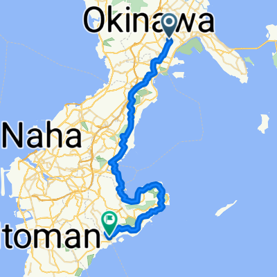 Okinawa - Itoman
- Distance
- 48.1 km
- Ascent
- 767 m
- Descent
- 781 m
- Location
- Okinawa, Okinawa, Japan
 toguchi beach
- Distance
- 1.1 km
- Ascent
- 0 m
- Descent
- 8 m
- Location
- Okinawa, Okinawa, Japan
 28-11, Nakasonecho, Okinawa-Shi to Đường Mười Bảy Tháng Tám, Tp. Tuyên Quang
- Distance
- 5,600 km
- Ascent
- 1,387 m
- Descent
- 1,469 m
- Location
- Okinawa, Okinawa, Japan
 murasaki beach
- Distance
- 15.6 km
- Ascent
- 112 m
- Descent
- 138 m
- Location
- Okinawa, Okinawa, Japan
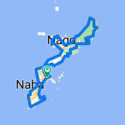 Japan- Okinawa
- Distance
- 412.5 km
- Ascent
- 5,772 m
- Descent
- 5,831 m
- Location
- Okinawa, Okinawa, Japan
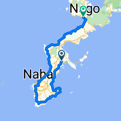 Okinawa - Nago
- Distance
- 154 km
- Ascent
- 1,552 m
- Descent
- 1,598 m
- Location
- Okinawa, Okinawa, Japan
Open it in the app