

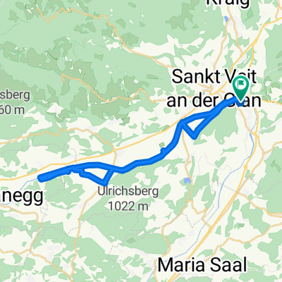
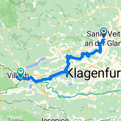
Von Villach bis Číměř
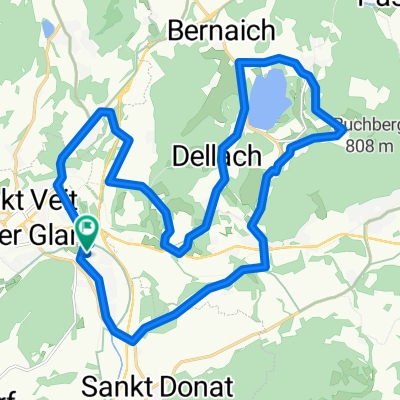
Sankt Veit an der Glan - Sankt Marein bei Neumarkt
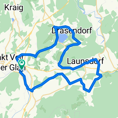
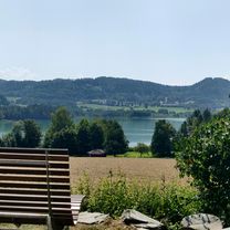
A cycling route starting in Sankt Veit an der Glan, Carinthia, Austria.
Overview
About this route
- 2 h 26 min
- Duration
- 39.3 km
- Distance
- 835 m
- Ascent
- 510 m
- Descent
- 16.2 km/h
- Avg. speed
- 815 m
- Max. altitude
Part of
Von Villach bis Číměř
13 stages
Route quality
Waytypes & surfaces along the route
Waytypes
Quiet road
9.4 km
(24 %)
Path
9.4 km
(24 %)
Surfaces
Paved
29.1 km
(74 %)
Asphalt
29.1 km
(74 %)
Undefined
10.2 km
(26 %)
Continue with Bikemap
Use, edit, or download this cycling route
You would like to ride Sankt Veit an der Glan - Sankt Marein bei Neumarkt or customize it for your own trip? Here is what you can do with this Bikemap route:
Free features
- Save this route as favorite or in collections
- Copy & plan your own version of this route
- Sync your route with Garmin or Wahoo
Premium features
Free trial for 3 days, or one-time payment. More about Bikemap Premium.
- Navigate this route on iOS & Android
- Export a GPX / KML file of this route
- Create your custom printout (try it for free)
- Download this route for offline navigation
Discover more Premium features.
Get Bikemap PremiumFrom our community
Other popular routes starting in Sankt Veit an der Glan
 Untermühlbach - Hochosterwitz - Thalsdorf - Längsee - Schwag
- Distance
- 30.7 km
- Ascent
- 505 m
- Descent
- 503 m
- Location
- Sankt Veit an der Glan, Carinthia, Austria
 Glanweg-Haidach-Rohnsdorf-Muraunbergweg
- Distance
- 29 km
- Ascent
- 83 m
- Descent
- 129 m
- Location
- Sankt Veit an der Glan, Carinthia, Austria
 Kleine Scheifling/Taggenbrunnrunde
- Distance
- 9 km
- Ascent
- 218 m
- Descent
- 220 m
- Location
- Sankt Veit an der Glan, Carinthia, Austria
 D6_b_S. Vait a G _ Villach
- Distance
- 77.6 km
- Ascent
- 976 m
- Descent
- 969 m
- Location
- Sankt Veit an der Glan, Carinthia, Austria
 D6_b_S. Vait a G _ Villach
- Distance
- 75.5 km
- Ascent
- 978 m
- Descent
- 971 m
- Location
- Sankt Veit an der Glan, Carinthia, Austria
 Zollfeld - Treffelsdorf - StDonat - Podeblach - Goggerwenig - Hunnenbrunn
- Distance
- 30.3 km
- Ascent
- 516 m
- Descent
- 513 m
- Location
- Sankt Veit an der Glan, Carinthia, Austria
 St. Veit an der Glan - Taggennbrun
- Distance
- 21.5 km
- Ascent
- 479 m
- Descent
- 364 m
- Location
- Sankt Veit an der Glan, Carinthia, Austria
 UMühlbach - Stift - Längsee - StPeter - Taggenbrunn
- Distance
- 25.6 km
- Ascent
- 468 m
- Descent
- 473 m
- Location
- Sankt Veit an der Glan, Carinthia, Austria
Open it in the app