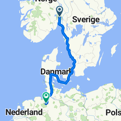
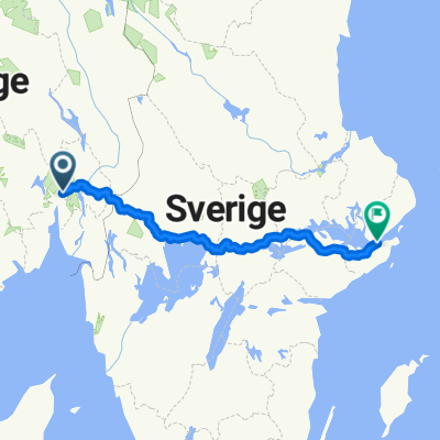
Elixia Ringnes park - Kikut over Voksenkollen
A cycling route starting in Oslo, Oslo County, Norway.
Overview
About this route
Utendørs "spinningtime" med Marius ved Elixia Ringnes park. Blandet gruppe på 8 personer, fra Ringnes park langs Akerselva og Maridalsvannet til Hammeren, Bjørnholt og Kikut. Videre ned til Sørkedalen, opp til Voksenkollen, langs Ring 3 til Tåsen og ned Uelandsgate tilbake til Ringnes park. Total tid inklusive pauser: 3t 5m.
- -:--
- Duration
- 53 km
- Distance
- 739 m
- Ascent
- 663 m
- Descent
- ---
- Avg. speed
- 438 m
- Max. altitude
Route quality
Waytypes & surfaces along the route
Waytypes
Quiet road
23.3 km
(44 %)
Road
10.6 km
(20 %)
Surfaces
Paved
27.6 km
(52 %)
Unpaved
24.4 km
(46 %)
Asphalt
27.6 km
(52 %)
Gravel
16.4 km
(31 %)
Continue with Bikemap
Use, edit, or download this cycling route
You would like to ride Elixia Ringnes park - Kikut over Voksenkollen or customize it for your own trip? Here is what you can do with this Bikemap route:
Free features
- Save this route as favorite or in collections
- Copy & plan your own version of this route
- Sync your route with Garmin or Wahoo
Premium features
Free trial for 3 days, or one-time payment. More about Bikemap Premium.
- Navigate this route on iOS & Android
- Export a GPX / KML file of this route
- Create your custom printout (try it for free)
- Download this route for offline navigation
Discover more Premium features.
Get Bikemap PremiumFrom our community
Other popular routes starting in Oslo
Maybe2022- Distance
- 491.1 km
- Ascent
- 2,831 m
- Descent
- 2,855 m
- Location
- Oslo, Oslo County, Norway
Ullevål til Storo- Distance
- 4.5 km
- Ascent
- 69 m
- Descent
- 89 m
- Location
- Oslo, Oslo County, Norway
Emanuel Vigeland Museum and Parks Circle- Distance
- 17.4 km
- Ascent
- 189 m
- Descent
- 192 m
- Location
- Oslo, Oslo County, Norway
Trek Bergen - Oslo : Part8 : Amot - Oslo (with a part of Silver road)- Distance
- 87 km
- Ascent
- 445 m
- Descent
- 393 m
- Location
- Oslo, Oslo County, Norway
Oslo-Göteborg 1 (Unionsleden/Vänersleden))- Distance
- 474.9 km
- Ascent
- 5,197 m
- Descent
- 5,203 m
- Location
- Oslo, Oslo County, Norway
OSL-HAM - Part 1 Color Line Terminal - Rykkinn- Distance
- 17.4 km
- Ascent
- 347 m
- Descent
- 276 m
- Location
- Oslo, Oslo County, Norway
Oslo de Mortel deel 1- Distance
- 761 km
- Ascent
- 701 m
- Descent
- 717 m
- Location
- Oslo, Oslo County, Norway
oslo to Bremen- Distance
- 1,310.3 km
- Ascent
- 4,296 m
- Descent
- 4,282 m
- Location
- Oslo, Oslo County, Norway
Open it in the app

