

2012.07.14.Transalp2012-day 6
A cycling route starting in Ultimo - Ulten, Trentino-Alto Adige, Italy.
Overview
About this route
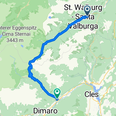
<span style="color: #555555; font-family: Georgia, sans-serif; font-size: 13px; line-height: 17px; text-align: justify;">St. Walburg - Rabbijoch (2449m) - Dimaro - Monte Vigo (2043m) - Madonna di Campiglio</span>
- -:--
- Duration
- 67.2 km
- Distance
- 2,888 m
- Ascent
- 2,444 m
- Descent
- ---
- Avg. speed
- ---
- Max. altitude

Continue with Bikemap
Use, edit, or download this cycling route
You would like to ride 2012.07.14.Transalp2012-day 6 or customize it for your own trip? Here is what you can do with this Bikemap route:
Free features
- Save this route as favorite or in collections
- Copy & plan your own version of this route
- Sync your route with Garmin or Wahoo
Premium features
Free trial for 3 days, or one-time payment. More about Bikemap Premium.
- Navigate this route on iOS & Android
- Export a GPX / KML file of this route
- Create your custom printout (try it for free)
- Download this route for offline navigation
Discover more Premium features.
Get Bikemap PremiumFrom our community
Other popular routes starting in Ultimo - Ulten
 AC_ET4b_St.Walburg-Cles
- Distance
- 54.8 km
- Ascent
- 1,468 m
- Descent
- 1,914 m
- Location
- Ultimo - Ulten, Trentino-Alto Adige, Italy
 Ultimo - Ulten - Malé
- Distance
- 40.1 km
- Ascent
- 1,239 m
- Descent
- 1,643 m
- Location
- Ultimo - Ulten, Trentino-Alto Adige, Italy
 2012.07.14.Transalp2012-day 6
- Distance
- 67.2 km
- Ascent
- 2,888 m
- Descent
- 2,444 m
- Location
- Ultimo - Ulten, Trentino-Alto Adige, Italy
 GSFT 5 St. Walburg - Lavis
- Distance
- 74.9 km
- Ascent
- 1,122 m
- Descent
- 2,038 m
- Location
- Ultimo - Ulten, Trentino-Alto Adige, Italy
 Alpencross E7 Ulten_Eggwirt-HaselgruberHütte
- Distance
- 23.3 km
- Ascent
- 1,439 m
- Descent
- 143 m
- Location
- Ultimo - Ulten, Trentino-Alto Adige, Italy
 AÜ Tag 4 : St. Walburg - Cles-Campodenno
- Distance
- 59.4 km
- Ascent
- 1,254 m
- Descent
- 1,870 m
- Location
- Ultimo - Ulten, Trentino-Alto Adige, Italy
 20160629_080658.gpx
- Distance
- 70.2 km
- Ascent
- 1,818 m
- Descent
- 2,506 m
- Location
- Ultimo - Ulten, Trentino-Alto Adige, Italy
 Route im Schneckentempo in Spiazzo
- Distance
- 31.2 km
- Ascent
- 0 m
- Descent
- 0 m
- Location
- Ultimo - Ulten, Trentino-Alto Adige, Italy
Open it in the app