
08-15-2025 🚴 bike ride
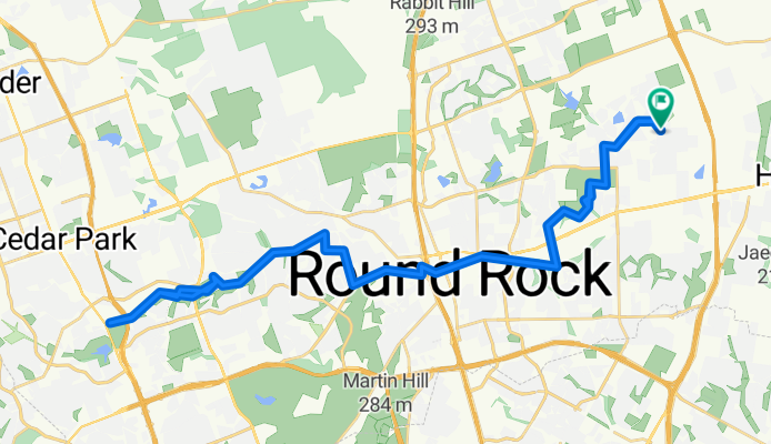
A cycling route starting in Hutto, Texas, United States.
Overview
About this route
- 2 h 48 min
- Duration
- 65.9 km
- Distance
- 272 m
- Ascent
- 242 m
- Descent
- 23.5 km/h
- Avg. speed
- 264 m
- Max. altitude

Route photos


Continue with Bikemap
Use, edit, or download this cycling route
You would like to ride 08-15-2025 🚴 bike ride or customize it for your own trip? Here is what you can do with this Bikemap route:
Free features
- Save this route as favorite or in collections
- Copy & plan your own version of this route
- Sync your route with Garmin or Wahoo
Premium features
Free trial for 3 days, or one-time payment. More about Bikemap Premium.
- Navigate this route on iOS & Android
- Export a GPX / KML file of this route
- Create your custom printout (try it for free)
- Download this route for offline navigation
Discover more Premium features.
Get Bikemap PremiumFrom our community
Other popular routes starting in Hutto
 North Co Road to East Old Settlers Boulevard
- Distance
- 15.4 km
- Ascent
- 60 m
- Descent
- 41 m
- Location
- Hutto, Texas, United States
 08-11-23 🚴bike ride
- Distance
- 53.8 km
- Ascent
- 162 m
- Descent
- 161 m
- Location
- Hutto, Texas, United States
 30 mile
- Distance
- 48.6 km
- Ascent
- 115 m
- Descent
- 116 m
- Location
- Hutto, Texas, United States
 8.7 mile
- Distance
- 14 km
- Ascent
- 20 m
- Descent
- 21 m
- Location
- Hutto, Texas, United States
 08-15-2025 🚴 bike ride
- Distance
- 65.9 km
- Ascent
- 272 m
- Descent
- 242 m
- Location
- Hutto, Texas, United States
 146–176 E Front St, Hutto to 133 Gainer Dr, Hutto
- Distance
- 31.3 km
- Ascent
- 76 m
- Descent
- 79 m
- Location
- Hutto, Texas, United States
 bike route
- Distance
- 2.2 km
- Ascent
- 0 m
- Descent
- 0 m
- Location
- Hutto, Texas, United States
 day flat tire
- Distance
- 11.4 km
- Ascent
- 135 m
- Descent
- 138 m
- Location
- Hutto, Texas, United States
Open it in the app