
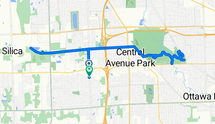
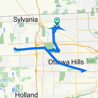
N McCord Rd, Toledo to N McCord Rd, Toledo
A cycling route starting in Sylvania, Ohio, United States of America.
Overview
About this route
- 1 h 25 min
- Duration
- 20.7 km
- Distance
- 206 m
- Ascent
- 203 m
- Descent
- 14.6 km/h
- Avg. speed
- 217 m
- Max. altitude
Route photos


Route quality
Waytypes & surfaces along the route
Waytypes
Cycleway
14.2 km
(69 %)
Access road
2.4 km
(12 %)
Surfaces
Paved
8 km
(39 %)
Paved (undefined)
4.7 km
(23 %)
Concrete
3.1 km
(15 %)
Continue with Bikemap
Use, edit, or download this cycling route
You would like to ride N McCord Rd, Toledo to N McCord Rd, Toledo or customize it for your own trip? Here is what you can do with this Bikemap route:
Free features
- Save this route as favorite or in collections
- Copy & plan your own version of this route
- Sync your route with Garmin or Wahoo
Premium features
Free trial for 3 days, or one-time payment. More about Bikemap Premium.
- Navigate this route on iOS & Android
- Export a GPX / KML file of this route
- Create your custom printout (try it for free)
- Download this route for offline navigation
Discover more Premium features.
Get Bikemap PremiumFrom our community
Other popular routes starting in Sylvania
 Ut trail
- Distance
- 9.2 km
- Ascent
- 381 m
- Descent
- 401 m
- Location
- Sylvania, Ohio, United States of America
 7257 Whispering Oak Dr, Sylvania to 7257 Whispering Oak Dr, Sylvania
- Distance
- 28 km
- Ascent
- 3,692 m
- Descent
- 3,693 m
- Location
- Sylvania, Ohio, United States of America
 High Oaks Boulevard 4828, Toledo to High Oaks Boulevard 4818, Toledo
- Distance
- 37.6 km
- Ascent
- 47 m
- Descent
- 49 m
- Location
- Sylvania, Ohio, United States of America
 N McCord Rd, Toledo to N McCord Rd, Toledo
- Distance
- 20.7 km
- Ascent
- 206 m
- Descent
- 203 m
- Location
- Sylvania, Ohio, United States of America
 Quarry Ridge Trail, Sylvania to 9529–9577 Maybee Scofield Rd, Maybee
- Distance
- 52.8 km
- Ascent
- 111 m
- Descent
- 115 m
- Location
- Sylvania, Ohio, United States of America
 Phil-Work
- Distance
- 28.7 km
- Ascent
- 15 m
- Descent
- 41 m
- Location
- Sylvania, Ohio, United States of America
 High Oaks Boulevard 4818, Toledo to High Oaks Boulevard 4828, Toledo
- Distance
- 37.7 km
- Ascent
- 53 m
- Descent
- 52 m
- Location
- Sylvania, Ohio, United States of America
 High Oaks Boulevard 4818, Toledo to High Oaks Boulevard 4818, Toledo
- Distance
- 39.3 km
- Ascent
- 48 m
- Descent
- 47 m
- Location
- Sylvania, Ohio, United States of America
Open it in the app