
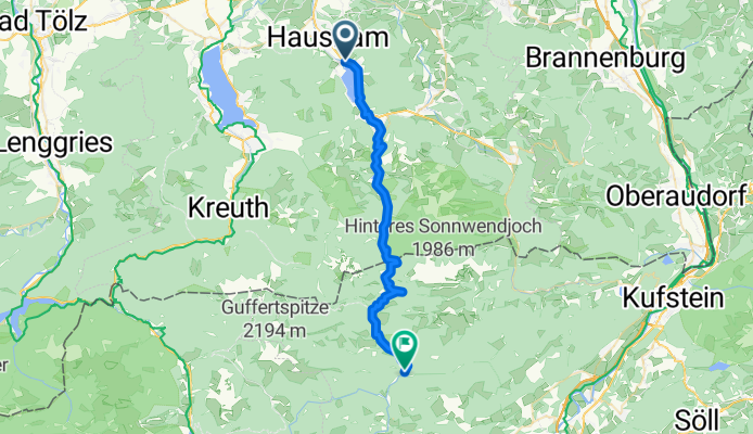
Von Schliersee bis Bruneck
Schliersee - Brandenberg
A cycling route starting in Schliersee, Bavaria, Germany.
Overview
About this route
- 2 h 48 min
- Duration
- 33.4 km
- Distance
- 1,433 m
- Ascent
- 1,465 m
- Descent
- 11.9 km/h
- Avg. speed
- 1,139 m
- Max. altitude

Part of
Von Schliersee bis Bruneck
6 stages
Route quality
Waytypes & surfaces along the route
Waytypes
Track
22 km
(66 %)
Quiet road
2.7 km
(8 %)
Surfaces
Paved
14.4 km
(43 %)
Unpaved
18.4 km
(55 %)
Asphalt
14.4 km
(43 %)
Gravel
10 km
(30 %)
Continue with Bikemap
Use, edit, or download this cycling route
You would like to ride Schliersee - Brandenberg or customize it for your own trip? Here is what you can do with this Bikemap route:
Free features
- Save this route as favorite or in collections
- Copy & plan your own version of this route
- Sync your route with Garmin or Wahoo
Premium features
Free trial for 3 days, or one-time payment. More about Bikemap Premium.
- Navigate this route on iOS & Android
- Export a GPX / KML file of this route
- Create your custom printout (try it for free)
- Download this route for offline navigation
Discover more Premium features.
Get Bikemap PremiumFrom our community
Other popular routes starting in Schliersee
 Wörnsmühle Auerberg Rundtour
- Distance
- 18.5 km
- Ascent
- 478 m
- Descent
- 478 m
- Location
- Schliersee, Bavaria, Germany
 Gindelalm
- Distance
- 34.3 km
- Ascent
- 1,139 m
- Descent
- 1,139 m
- Location
- Schliersee, Bavaria, Germany
 ab Schliersee rund um den Wendelstein
- Distance
- 68.2 km
- Ascent
- 933 m
- Descent
- 933 m
- Location
- Schliersee, Bavaria, Germany
 Schliersee Tegernsee Rundfahrt
- Distance
- 54.2 km
- Ascent
- 364 m
- Descent
- 364 m
- Location
- Schliersee, Bavaria, Germany
 Schliersberg
- Distance
- 14.3 km
- Ascent
- 668 m
- Descent
- 669 m
- Location
- Schliersee, Bavaria, Germany
 Let's kill the Hill
- Distance
- 136.6 km
- Ascent
- 1,317 m
- Descent
- 1,316 m
- Location
- Schliersee, Bavaria, Germany
 Schliersee - Rohnberg - Neuhaus
- Distance
- 29.5 km
- Ascent
- 1,140 m
- Descent
- 1,144 m
- Location
- Schliersee, Bavaria, Germany
 Schliersee nach Mühlthal, Valley
- Distance
- 18.3 km
- Ascent
- 314 m
- Descent
- 491 m
- Location
- Schliersee, Bavaria, Germany
Open it in the app