
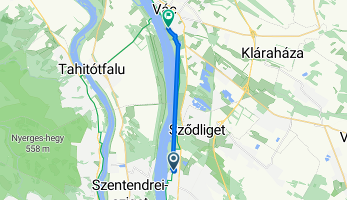
Attila utca, Göd - József Attila sétány, Vác
A cycling route starting in Sződliget, Pest County, Hungary.
Overview
About this route
- 47 min
- Duration
- 7.4 km
- Distance
- 15 m
- Ascent
- 16 m
- Descent
- 9.4 km/h
- Avg. speed
- 120 m
- Max. altitude
Route photos


Route quality
Waytypes & surfaces along the route
Waytypes
Cycleway
7.2 km
(98 %)
Living street
0.1 km
(1 %)
Surfaces
Paved
7.3 km
(99 %)
Asphalt
7.1 km
(97 %)
Concrete
0.2 km
(2 %)
Undefined
0.1 km
(<1 %)
Continue with Bikemap
Use, edit, or download this cycling route
You would like to ride Attila utca, Göd - József Attila sétány, Vác or customize it for your own trip? Here is what you can do with this Bikemap route:
Free features
- Save this route as favorite or in collections
- Copy & plan your own version of this route
- Sync your route with Garmin or Wahoo
Premium features
Free trial for 3 days, or one-time payment. More about Bikemap Premium.
- Navigate this route on iOS & Android
- Export a GPX / KML file of this route
- Create your custom printout (try it for free)
- Download this route for offline navigation
Discover more Premium features.
Get Bikemap PremiumFrom our community
Other popular routes starting in Sződliget
 Magyarország körtúra
- Distance
- 1,377.1 km
- Ascent
- 1,914 m
- Descent
- 1,916 m
- Location
- Sződliget, Pest County, Hungary
 ride from Sződliget to Szentendre
- Distance
- 22 km
- Ascent
- 123 m
- Descent
- 79 m
- Location
- Sződliget, Pest County, Hungary
 Szodliget - Borzsony - Dunakanyar
- Distance
- 82.9 km
- Ascent
- 342 m
- Descent
- 342 m
- Location
- Sződliget, Pest County, Hungary
 Attila utca, Göd - József Attila sétány, Vác
- Distance
- 7.4 km
- Ascent
- 15 m
- Descent
- 16 m
- Location
- Sződliget, Pest County, Hungary
 Dunakanyar Göd - Vác - Verőce
- Distance
- 18.5 km
- Ascent
- 55 m
- Descent
- 52 m
- Location
- Sződliget, Pest County, Hungary
 göd vác light
- Distance
- 9.9 km
- Ascent
- 38 m
- Descent
- 34 m
- Location
- Sződliget, Pest County, Hungary
 Gödi Rétesház kör - Spiki
- Distance
- 76 km
- Ascent
- 318 m
- Descent
- 316 m
- Location
- Sződliget, Pest County, Hungary
 sződliget-rád-penc-galgamácsa-váchartyán-csörög-sződ
- Distance
- 66.8 km
- Ascent
- 248 m
- Descent
- 250 m
- Location
- Sződliget, Pest County, Hungary
Open it in the app