
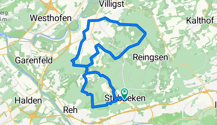
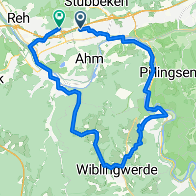
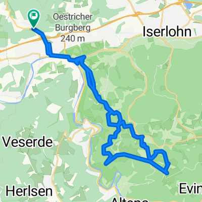
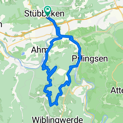
Siepenpad, Iserlohn to Siepenpad, Iserlohn
A cycling route starting in Nachrodt-Wiblingwerde, North Rhine-Westphalia, Germany.
Overview
About this route
- 1 h 47 min
- Duration
- 25.9 km
- Distance
- 559 m
- Ascent
- 559 m
- Descent
- 14.6 km/h
- Avg. speed
- 261 m
- Max. altitude
Route quality
Waytypes & surfaces along the route
Waytypes
Track
12.9 km
(50 %)
Quiet road
5.4 km
(21 %)
Surfaces
Paved
7.2 km
(28 %)
Unpaved
9.1 km
(35 %)
Asphalt
6.5 km
(25 %)
Gravel
5.4 km
(21 %)
Continue with Bikemap
Use, edit, or download this cycling route
You would like to ride Siepenpad, Iserlohn to Siepenpad, Iserlohn or customize it for your own trip? Here is what you can do with this Bikemap route:
Free features
- Save this route as favorite or in collections
- Copy & plan your own version of this route
- Sync your route with Garmin or Wahoo
Premium features
Free trial for 3 days, or one-time payment. More about Bikemap Premium.
- Navigate this route on iOS & Android
- Export a GPX / KML file of this route
- Create your custom printout (try it for free)
- Download this route for offline navigation
Discover more Premium features.
Get Bikemap PremiumFrom our community
Other popular routes starting in Nachrodt-Wiblingwerde
 Mountainbike Tour Wandertag 2009
- Distance
- 22.2 km
- Ascent
- 482 m
- Descent
- 482 m
- Location
- Nachrodt-Wiblingwerde, North Rhine-Westphalia, Germany
 lethmate wiblingwerde oege
- Distance
- 24 km
- Ascent
- 504 m
- Descent
- 527 m
- Location
- Nachrodt-Wiblingwerde, North Rhine-Westphalia, Germany
 Hohenlimburg nach Lethmate
- Distance
- 48.6 km
- Ascent
- 441 m
- Descent
- 444 m
- Location
- Nachrodt-Wiblingwerde, North Rhine-Westphalia, Germany
 Runde Pillingsen, Hegenscheid
- Distance
- 30.3 km
- Ascent
- 987 m
- Descent
- 987 m
- Location
- Nachrodt-Wiblingwerde, North Rhine-Westphalia, Germany
 In der Hardt 4, Nachrodt-Wiblingwerde nach In der Hardt 4, Nachrodt-Wiblingwerde
- Distance
- 36.6 km
- Ascent
- 472 m
- Descent
- 468 m
- Location
- Nachrodt-Wiblingwerde, North Rhine-Westphalia, Germany
 Obernahmerstraße 58, Hagen do Obernahmerstraße 58, Hagen
- Distance
- 13.9 km
- Ascent
- 266 m
- Descent
- 265 m
- Location
- Nachrodt-Wiblingwerde, North Rhine-Westphalia, Germany
 Ruhrtal & Sauerland
- Distance
- 72.9 km
- Ascent
- 483 m
- Descent
- 486 m
- Location
- Nachrodt-Wiblingwerde, North Rhine-Westphalia, Germany
 Runde Rennerde, Veserde
- Distance
- 22.6 km
- Ascent
- 545 m
- Descent
- 545 m
- Location
- Nachrodt-Wiblingwerde, North Rhine-Westphalia, Germany
Open it in the app