
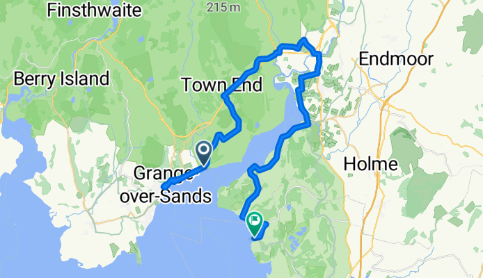
Bay Cycle Way
A cycling route starting in Grange-over-Sands, England, United Kingdom.
Overview
About this route
- 2 h 7 min
- Duration
- 35.7 km
- Distance
- 226 m
- Ascent
- 217 m
- Descent
- 16.9 km/h
- Avg. speed
- 74 m
- Max. altitude

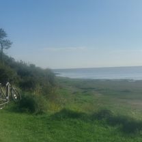
Route photos


Route quality
Waytypes & surfaces along the route
Waytypes
Quiet road
12.7 km
(36 %)
Busy road
11.3 km
(32 %)
Surfaces
Paved
19.6 km
(55 %)
Unpaved
0.1 km
(<1 %)
Asphalt
19.3 km
(54 %)
Paved (undefined)
0.2 km
(<1 %)
Continue with Bikemap
Use, edit, or download this cycling route
You would like to ride Bay Cycle Way or customize it for your own trip? Here is what you can do with this Bikemap route:
Free features
- Save this route as favorite or in collections
- Copy & plan your own version of this route
- Sync your route with Garmin or Wahoo
Premium features
Free trial for 3 days, or one-time payment. More about Bikemap Premium.
- Navigate this route on iOS & Android
- Export a GPX / KML file of this route
- Create your custom printout (try it for free)
- Download this route for offline navigation
Discover more Premium features.
Get Bikemap PremiumFrom our community
Other popular routes starting in Grange-over-Sands
 e bike route
- Distance
- 41.5 km
- Ascent
- 565 m
- Descent
- 570 m
- Location
- Grange-over-Sands, England, United Kingdom
 Henry evening ride training
- Distance
- 18.6 km
- Ascent
- 279 m
- Descent
- 284 m
- Location
- Grange-over-Sands, England, United Kingdom
 Cartmel - Ambleside - Coniston
- Distance
- 76.1 km
- Ascent
- 407 m
- Descent
- 407 m
- Location
- Grange-over-Sands, England, United Kingdom
 16-4- 28 training ride Grizeley
- Distance
- 58 km
- Ascent
- 609 m
- Descent
- 607 m
- Location
- Grange-over-Sands, England, United Kingdom
 bridle ways test cartmel 16miles
- Distance
- 30.8 km
- Ascent
- 456 m
- Descent
- 456 m
- Location
- Grange-over-Sands, England, United Kingdom
 28 mile practice route
- Distance
- 45.6 km
- Ascent
- 396 m
- Descent
- 395 m
- Location
- Grange-over-Sands, England, United Kingdom
 Bay Cycle Way
- Distance
- 35.7 km
- Ascent
- 226 m
- Descent
- 217 m
- Location
- Grange-over-Sands, England, United Kingdom
 2020 lakeland trail route 3
- Distance
- 21.9 km
- Ascent
- 345 m
- Descent
- 321 m
- Location
- Grange-over-Sands, England, United Kingdom
Open it in the app