Montelimar - Grignan 60km
A cycling route starting in Montboucher-sur-Jabron, Auvergne-Rh么ne-Alpes, France.
Overview
About this route
- 1 h 44 min
- Duration
- 27.9 km
- Distance
- 552 m
- Ascent
- 464 m
- Descent
- 16.1 km/h
- Avg. speed
- 432 m
- Max. altitude
Route quality
Waytypes & surfaces along the route
Waytypes
Track
9.3 km
(33 %)
Cycleway
5.8 km
(21 %)
Surfaces
Paved
11.4 km
(41 %)
Unpaved
3.4 km
(12 %)
Asphalt
6.9 km
(25 %)
Paved (undefined)
4.4 km
(16 %)
Continue with Bikemap
Use, edit, or download this cycling route
You would like to ride Montelimar - Grignan 60km or customize it for your own trip? Here is what you can do with this Bikemap route:
Free features
- Save this route as favorite or in collections
- Copy & plan your own version of this route
- Sync your route with Garmin or Wahoo
Premium features
Free trial for 3 days, or one-time payment. More about Bikemap Premium.
- Navigate this route on iOS & Android
- Export a GPX / KML file of this route
- Create your custom printout (try it for free)
- Download this route for offline navigation
Discover more Premium features.
Get Bikemap PremiumFrom our community
Other popular routes starting in Montboucher-sur-Jabron
- Itin茅raire vers aO玫d垄?
- Distance
- 0.8 km
- Ascent
- 0 m
- Descent
- 64 m
- Location
- Montboucher-sur-Jabron, Auvergne-Rh么ne-Alpes, France
- Mont茅limar - S茅rignan-plage
- Distance
- 419.9 km
- Ascent
- 3,654 m
- Descent
- 3,758 m
- Location
- Montboucher-sur-Jabron, Auvergne-Rh么ne-Alpes, France
- Mont茅limar 脿 4 Rue de Syrah, Savasse
- Distance
- 5.1 km
- Ascent
- 71 m
- Descent
- 24 m
- Location
- Montboucher-sur-Jabron, Auvergne-Rh么ne-Alpes, France
- velo2
- Distance
- 38.7 km
- Ascent
- 597 m
- Descent
- 597 m
- Location
- Montboucher-sur-Jabron, Auvergne-Rh么ne-Alpes, France
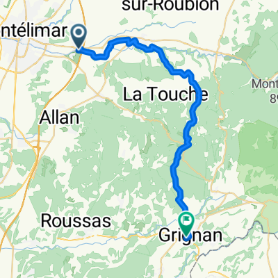
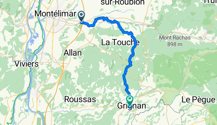
- Tour de France 2009, Etappe 20 - 167,0 km
- Distance
- 166.9 km
- Ascent
- 3,361 m
- Descent
- 2,696 m
- Location
- Montboucher-sur-Jabron, Auvergne-Rh么ne-Alpes, France
- Etapa 14
- Distance
- 209.5 km
- Ascent
- 1,319 m
- Descent
- 1,137 m
- Location
- Montboucher-sur-Jabron, Auvergne-Rh么ne-Alpes, France
- Montelimar - Grignan 60km
- Distance
- 27.9 km
- Ascent
- 552 m
- Descent
- 464 m
- Location
- Montboucher-sur-Jabron, Auvergne-Rh么ne-Alpes, France
- tdf 2017 stage 11
- Distance
- 196.3 km
- Ascent
- 2,431 m
- Descent
- 2,315 m
- Location
- Montboucher-sur-Jabron, Auvergne-Rh么ne-Alpes, France
Open it in the app