
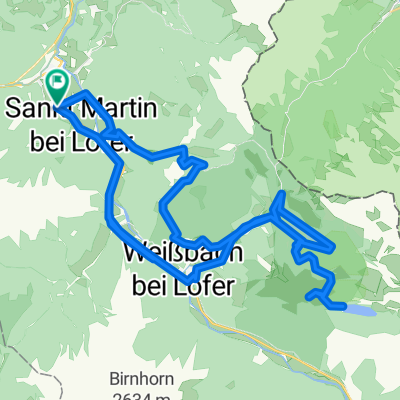
3A_ANGER
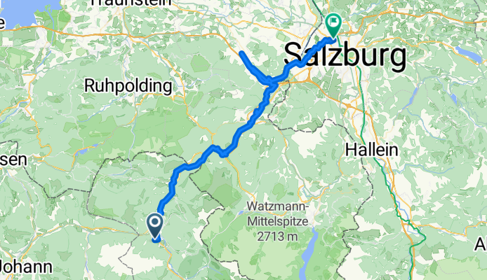
A cycling route starting in Sankt Martin bei Lofer, Salzburg, Austria.
Overview
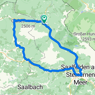
About this route
- 4 h 18 min
- Duration
- 63.8 km
- Distance
- 871 m
- Ascent
- 1,081 m
- Descent
- 14.9 km/h
- Avg. speed
- 648 m
- Max. altitude
Route quality
Waytypes & surfaces along the route
Waytypes
Quiet road
24.9 km
(39 %)
Path
11.5 km
(18 %)
Surfaces
Paved
40.8 km
(64 %)
Unpaved
14.7 km
(23 %)
Asphalt
39.6 km
(62 %)
Gravel
13.4 km
(21 %)
Continue with Bikemap
Use, edit, or download this cycling route
You would like to ride 3A_ANGER or customize it for your own trip? Here is what you can do with this Bikemap route:
Free features
- Save this route as favorite or in collections
- Copy & plan your own version of this route
- Sync your route with Garmin or Wahoo
Premium features
Free trial for 3 days, or one-time payment. More about Bikemap Premium.
- Navigate this route on iOS & Android
- Export a GPX / KML file of this route
- Create your custom printout (try it for free)
- Download this route for offline navigation
Discover more Premium features.
Get Bikemap PremiumFrom our community
Other popular routes starting in Sankt Martin bei Lofer
 Hochmoos - Lamprechtshöhle - Diesbachstausee - Kallbrunnalm - Wildental - Hochmoss
- Distance
- 51.7 km
- Ascent
- 2,678 m
- Descent
- 2,677 m
- Location
- Sankt Martin bei Lofer, Salzburg, Austria
 Hochmoos-Kirchental-Vorderkaserklamm-Hochmoos
- Distance
- 20 km
- Ascent
- 690 m
- Descent
- 689 m
- Location
- Sankt Martin bei Lofer, Salzburg, Austria
 Rund um die Reiter Alm (Wachterlrunde)
- Distance
- 57.7 km
- Ascent
- 2,066 m
- Descent
- 2,066 m
- Location
- Sankt Martin bei Lofer, Salzburg, Austria
 Hochmoos-Hundalm-Reith-Au-Hochmoos
- Distance
- 32.6 km
- Ascent
- 1,436 m
- Descent
- 1,434 m
- Location
- Sankt Martin bei Lofer, Salzburg, Austria
 Gewerbegebiet, St. Martin nach Gewerbegebiet, St. Martin
- Distance
- 51.8 km
- Ascent
- 1,028 m
- Descent
- 1,029 m
- Location
- Sankt Martin bei Lofer, Salzburg, Austria
 Steinbergrunde-Lang-RR
- Distance
- 82.5 km
- Ascent
- 938 m
- Descent
- 938 m
- Location
- Sankt Martin bei Lofer, Salzburg, Austria
 Steinbergrunde
- Distance
- 72.7 km
- Ascent
- 1,294 m
- Descent
- 1,294 m
- Location
- Sankt Martin bei Lofer, Salzburg, Austria
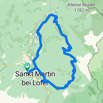
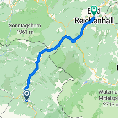 Sankt Martin bei Lofer - Bad Reichenhall
- Distance
- 28.6 km
- Ascent
- 659 m
- Descent
- 815 m
- Location
- Sankt Martin bei Lofer, Salzburg, Austria
Open it in the app