

Jagst-Radweg Walxheim - Kirchberg Tag1
A cycling route starting in Unterschneidheim, Baden-Wurttemberg, Germany.
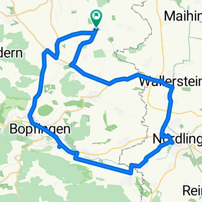
Overview
About this route
Start at the Jagst spring in Walxheim, otherwise Lauchheim (train connection)
The tour is very well marked
- -:--
- Duration
- 77 km
- Distance
- 179 m
- Ascent
- 283 m
- Descent
- ---
- Avg. speed
- ---
- Max. altitude

Route quality
Waytypes & surfaces along the route
Waytypes
Quiet road
26.2 km
(34 %)
Track
15.4 km
(20 %)
Surfaces
Paved
60.8 km
(79 %)
Unpaved
2.3 km
(3 %)
Asphalt
53.1 km
(69 %)
Paved (undefined)
7.7 km
(10 %)
Continue with Bikemap
Use, edit, or download this cycling route
You would like to ride Jagst-Radweg Walxheim - Kirchberg Tag1 or customize it for your own trip? Here is what you can do with this Bikemap route:
Free features
- Save this route as favorite or in collections
- Copy & plan your own version of this route
- Sync your route with Garmin or Wahoo
Premium features
Free trial for 3 days, or one-time payment. More about Bikemap Premium.
- Navigate this route on iOS & Android
- Export a GPX / KML file of this route
- Create your custom printout (try it for free)
- Download this route for offline navigation
Discover more Premium features.
Get Bikemap PremiumFrom our community
Other popular routes starting in Unterschneidheim
 mittel strecke
- Distance
- 6.8 km
- Ascent
- 82 m
- Descent
- 86 m
- Location
- Unterschneidheim, Baden-Wurttemberg, Germany
 Baldern-Schmähingen
- Distance
- 24.3 km
- Ascent
- 105 m
- Descent
- 226 m
- Location
- Unterschneidheim, Baden-Wurttemberg, Germany
 Deutschordenstraße 6, Unterschneidheim nach Baldinger Straße 34, Nördlingen
- Distance
- 12.2 km
- Ascent
- 38 m
- Descent
- 114 m
- Location
- Unterschneidheim, Baden-Wurttemberg, Germany
 ??¥œ? nach ??¥œ?
- Distance
- 19.4 km
- Ascent
- 217 m
- Descent
- 248 m
- Location
- Unterschneidheim, Baden-Wurttemberg, Germany
 Nördlinger Nordwest-Schleife
- Distance
- 39.2 km
- Ascent
- 168 m
- Descent
- 168 m
- Location
- Unterschneidheim, Baden-Wurttemberg, Germany
 Jagst-Radweg Walxheim - Kirchberg Tag1
- Distance
- 77 km
- Ascent
- 179 m
- Descent
- 283 m
- Location
- Unterschneidheim, Baden-Wurttemberg, Germany
 Unterschneidheim-Fürnheim
- Distance
- 21.4 km
- Ascent
- 209 m
- Descent
- 252 m
- Location
- Unterschneidheim, Baden-Wurttemberg, Germany
 Jagstursprung-Crailsheim
- Distance
- 53.9 km
- Ascent
- 96 m
- Descent
- 207 m
- Location
- Unterschneidheim, Baden-Wurttemberg, Germany
Open it in the app