
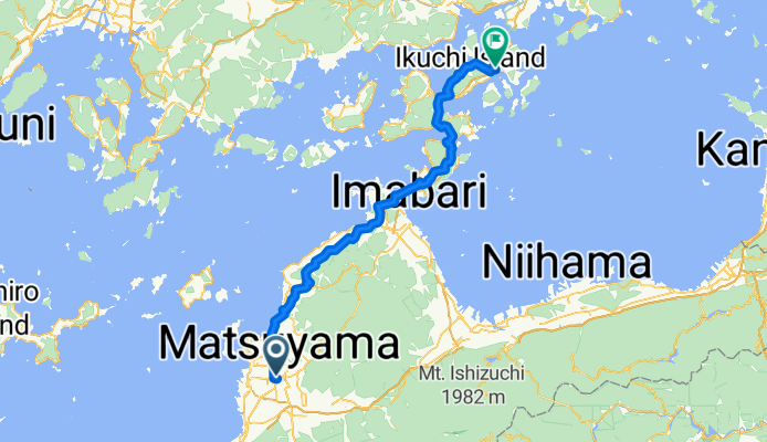
Overview
About this route
- 6 h 39 min
- Duration
- 100.9 km
- Distance
- 2,038 m
- Ascent
- 2,063 m
- Descent
- 15.2 km/h
- Avg. speed
- 194 m
- Max. altitude

Part of
ХИРОСИМА - ТОКИО 888км
12 stages
Route quality
Waytypes & surfaces along the route
Waytypes
Quiet road
66.6 km
(66 %)
Road
11.1 km
(11 %)
Surfaces
Paved
14.1 km
(14 %)
Paved (undefined)
9.1 km
(9 %)
Asphalt
5 km
(5 %)
Undefined
86.7 km
(86 %)
Continue with Bikemap
Use, edit, or download this cycling route
You would like to ride Matsuyama - Innoshima or customize it for your own trip? Here is what you can do with this Bikemap route:
Free features
- Save this route as favorite or in collections
- Copy & plan your own version of this route
- Split it into stages to create a multi-day tour
- Sync your route with Garmin or Wahoo
Premium features
Free trial for 3 days, or one-time payment. More about Bikemap Premium.
- Navigate this route on iOS & Android
- Export a GPX / KML file of this route
- Create your custom printout (try it for free)
- Download this route for offline navigation
Discover more Premium features.
Get Bikemap PremiumFrom our community
Other popular routes starting in Matsuyama
 松山Matsuyama-新居浜Niihama P-D8
- Distance
- 90.5 km
- Ascent
- 350 m
- Descent
- 369 m
- Location
- Matsuyama, Ehime, Japan
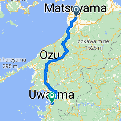 Matsuyama to Uwajima
- Distance
- 134 km
- Ascent
- 5,543 m
- Descent
- 5,548 m
- Location
- Matsuyama, Ehime, Japan
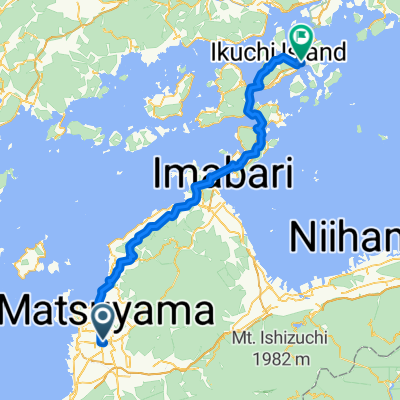 Matsuyama - Innoshima
- Distance
- 100.9 km
- Ascent
- 2,038 m
- Descent
- 2,063 m
- Location
- Matsuyama, Ehime, Japan
 shikoku
- Distance
- 207 km
- Ascent
- 765 m
- Descent
- 766 m
- Location
- Matsuyama, Ehime, Japan
 ХИРОСИМА - ТОКИО 888км
- Distance
- 1,152.5 km
- Ascent
- 13,595 m
- Descent
- 13,606 m
- Location
- Matsuyama, Ehime, Japan
 Shikoku
- Distance
- 538.5 km
- Ascent
- 3,185 m
- Descent
- 3,136 m
- Location
- Matsuyama, Ehime, Japan
 day 29.1. Shinkoku 2
- Distance
- 12.6 km
- Ascent
- 114 m
- Descent
- 93 m
- Location
- Matsuyama, Ehime, Japan
 3-8, Ichibancho 3-Chōme, Matsuyama to 3752, Hijikawachouwagawa, Ozu
- Distance
- 61.5 km
- Ascent
- 2,168 m
- Descent
- 2,100 m
- Location
- Matsuyama, Ehime, Japan
Open it in the app