
Starnberger-See Radtour
A cycling route starting in Starnberg, Bavaria, Germany.
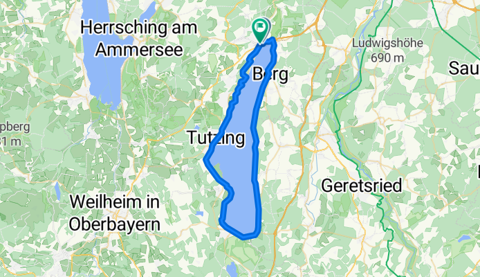
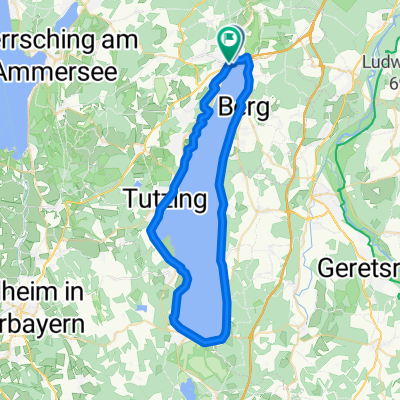
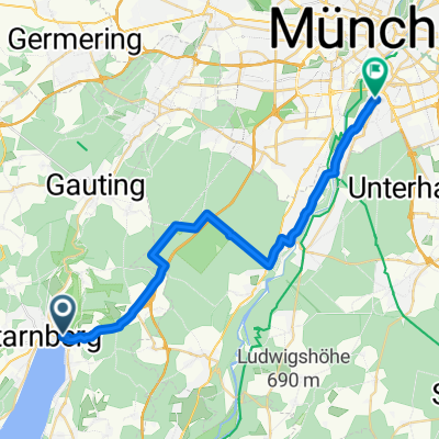
Overview
About this route
A95 and A 952 or B2 to Starnberg
We start this tour at the Starnberg train station. Already here we can follow the bike path signs, which are easy to find all around the lake. First, our ride passes by the water park in Starnberg. Through a wooded area, along the public bathing beach, we reach Berg. Here, the road climbs steeply up to the castle park. In the park stands the votive chapel, erected in memory of King Ludwig II., who drowned a few meters away in Lake Starnberg.
When we reach Assenhausen, we can make a detour to the impressive Bismarck tower. Now the ride becomes a bit more leisurely and the path leads directly along the shore. Just before Ammerland, we pass beautiful villas and also have the opportunity to refresh ourselves before continuing.
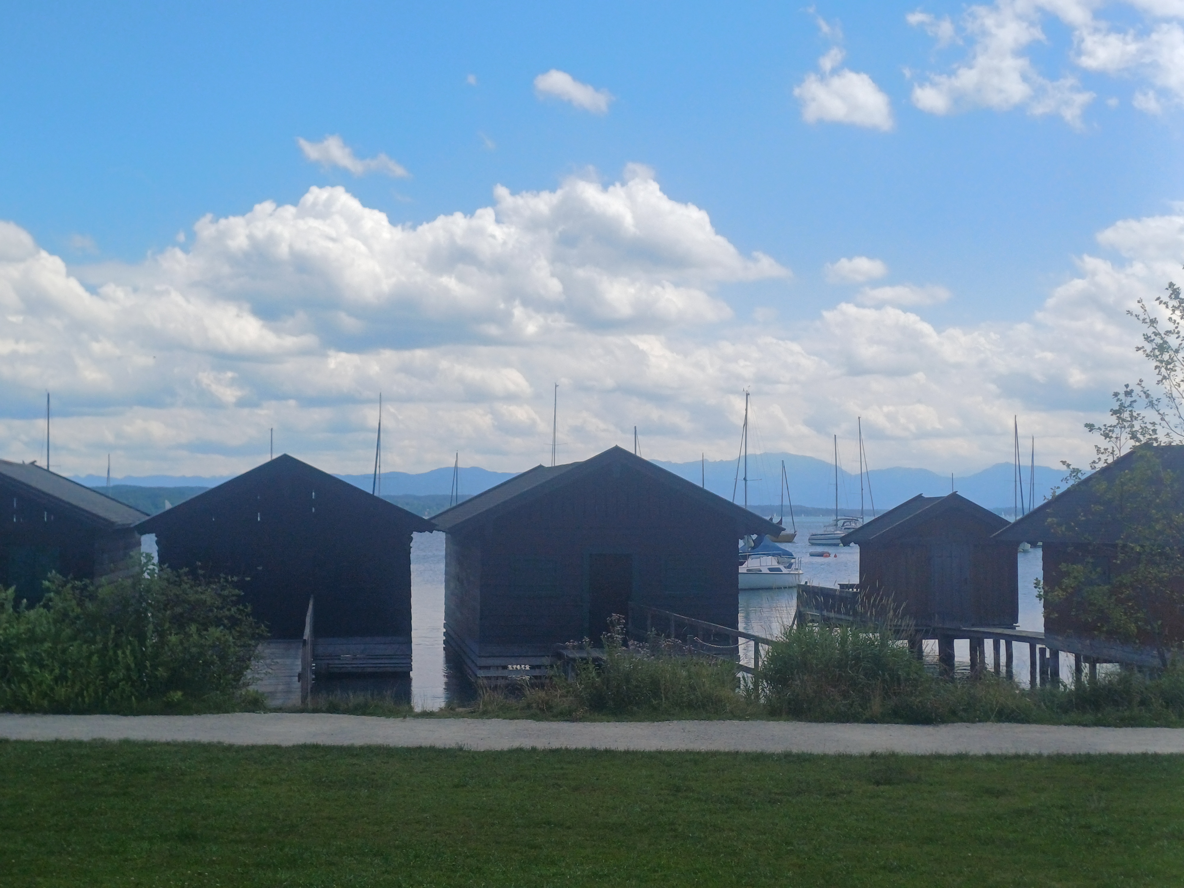
Over a bridge, we reach Ambach, where we must turn right to get back to the lakeside bike path. We pedal past campsites until St. Heinrich. In the Ambach recreational area, we find flat sandy beaches, whereas from Starnberg until here mostly pebbly beaches prevailed.
In Seeshaupt, it becomes more urban and the bike path runs parallel to the road. Soon we come across the guesthouse Seeseiten. Behind the guesthouse is a parking lot, after which we sharply turn right. We pass a small chapel and Seeseiten Castle. Through reeds and woods, we reach Bernrieder Park. This was donated in 1950 by Wilhelmina Busch-Woods. Many park benches give us a little break, and alongside, we have an excellent view over the lake. In the park, there are various paths, all leading to Bernried.
On the bike path running right next to the road, we reach the Buchheim Museum. Besides a permanent collection of expressionist works, you can admire numerous side exhibitions showing handicrafts from around the world. The bike path runs parallel to the road until Unterzeismering. Now we pass through the town, dismount and let the bike roll down beside a footpath with about 50 steps, before we arrive at Tutzing on beautiful shady paths, which we pass through along the town streets. Behind the grammar school in Tutzing, we turn right and then come back onto a bike path.
In Garatshausen, we can stop at the castle café. The castle is owned by the Thurn und Taxis family. An old people's home is housed in the front part and the castle chapel, which is open to visitors, is in the rear part. In Feldafing, we can cross by boat to the Rose Island like King Ludwig II. and Empress 'Sissi' once did. Feldafing also hosts the Hotel Kaiserin Elisabeth, and at the Possenhofen S-Bahn station, we can visit a 'Sissi' exhibition in the King's Salon and we also cycle past Possenhofen Castle, the childhood home of 'Sissi'. Behind Possenhofen, we cross the road and the parking lot on the other side. At the end of the parking lot, a forest path parallel to the railway lines leads us back to Starnberg.
In the residential area, we take Moritz-von-Schwind-Weg to the left over the railway line. Then we cycle right onto Wilhelmshöhenweg until we come through an underpass to the Undosa restaurant. Along the lake promenade, we reach the underpass. Through it, we return to our starting point, Starnberg train station.
- 3 h 4 min
- Duration
- 50.2 km
- Distance
- 203 m
- Ascent
- 204 m
- Descent
- 16.4 km/h
- Avg. speed
- 625 m
- Max. altitude
Route quality
Waytypes & surfaces along the route
Waytypes
Quiet road
15.5 km
(31 %)
Pedestrian area
9.5 km
(19 %)
Surfaces
Paved
26.6 km
(53 %)
Unpaved
17.6 km
(35 %)
Asphalt
24.6 km
(49 %)
Gravel
11 km
(22 %)
Continue with Bikemap
Use, edit, or download this cycling route
You would like to ride Starnberger-See Radtour or customize it for your own trip? Here is what you can do with this Bikemap route:
Free features
- Save this route as favorite or in collections
- Copy & plan your own version of this route
- Sync your route with Garmin or Wahoo
Premium features
Free trial for 3 days, or one-time payment. More about Bikemap Premium.
- Navigate this route on iOS & Android
- Export a GPX / KML file of this route
- Create your custom printout (try it for free)
- Download this route for offline navigation
Discover more Premium features.
Get Bikemap PremiumFrom our community
Other popular routes starting in Starnberg
 Runde um den Starnberger See
- Distance
- 55 km
- Ascent
- 421 m
- Descent
- 478 m
- Location
- Starnberg, Bavaria, Germany
 Mit dem Rad vom Starnberger See durchs Würmtal nach Pasing
- Distance
- 29.1 km
- Ascent
- 133 m
- Descent
- 195 m
- Location
- Starnberg, Bavaria, Germany
 Starnberger-See Radtour
- Distance
- 50.2 km
- Ascent
- 203 m
- Descent
- 204 m
- Location
- Starnberg, Bavaria, Germany
 Percha - Wolfratshausen - Percha
- Distance
- 28.7 km
- Ascent
- 278 m
- Descent
- 278 m
- Location
- Starnberg, Bavaria, Germany
 Traingsrunde nach Maising
- Distance
- 16.1 km
- Ascent
- 196 m
- Descent
- 161 m
- Location
- Starnberg, Bavaria, Germany
 Hotel Wetterstein-Starnberger See 27,5km
- Distance
- 27.5 km
- Ascent
- 193 m
- Descent
- 239 m
- Location
- Starnberg, Bavaria, Germany
 Starnberg Ufer Rundfahrt 50 KM
- Distance
- 49.8 km
- Ascent
- 45 m
- Descent
- 43 m
- Location
- Starnberg, Bavaria, Germany
 Am Ufer des Starnberger Sees
- Distance
- 52 km
- Ascent
- 260 m
- Descent
- 251 m
- Location
- Starnberg, Bavaria, Germany
Open it in the app