
Forst - Pauluskapelle - Odenheim - Bad Langenbrücken - Forst
A cycling route starting in Forst, Baden-Wurttemberg, Germany.
Overview
About this route
- 3 h
- Duration
- 37.2 km
- Distance
- 304 m
- Ascent
- 343 m
- Descent
- 12.4 km/h
- Avg. speed
- 253 m
- Max. altitude

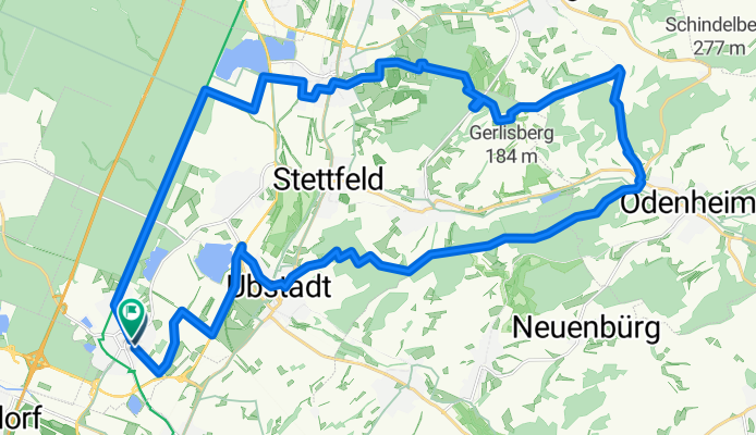
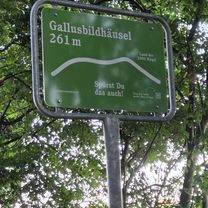
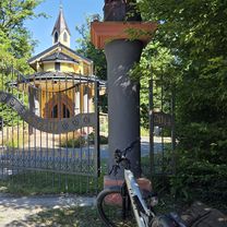
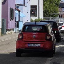
Route photos


Route quality
Waytypes & surfaces along the route
Waytypes
Track
27.5 km
(74 %)
Quiet road
7.8 km
(21 %)
Surfaces
Paved
26.8 km
(72 %)
Unpaved
9.7 km
(26 %)
Asphalt
21.2 km
(57 %)
Gravel
4.5 km
(12 %)
Continue with Bikemap
Use, edit, or download this cycling route
You would like to ride Forst - Pauluskapelle - Odenheim - Bad Langenbrücken - Forst or customize it for your own trip? Here is what you can do with this Bikemap route:
Free features
- Save this route as favorite or in collections
- Copy & plan your own version of this route
- Sync your route with Garmin or Wahoo
Premium features
Free trial for 3 days, or one-time payment. More about Bikemap Premium.
- Navigate this route on iOS & Android
- Export a GPX / KML file of this route
- Create your custom printout (try it for free)
- Download this route for offline navigation
Discover more Premium features.
Get Bikemap PremiumFrom our community
Other popular routes starting in Forst
 Forster Spargeltour, Tour 1-2015
- Distance
- 51.1 km
- Ascent
- 221 m
- Descent
- 223 m
- Location
- Forst, Baden-Wurttemberg, Germany
 Michaelsberg
- Distance
- 23.8 km
- Ascent
- 274 m
- Descent
- 316 m
- Location
- Forst, Baden-Wurttemberg, Germany
 Forst - Pauluskapelle - Odenheim - Bad Langenbrücken - Forst
- Distance
- 37.2 km
- Ascent
- 304 m
- Descent
- 343 m
- Location
- Forst, Baden-Wurttemberg, Germany
 Rundtour Rheinfähre
- Distance
- 61.8 km
- Ascent
- 82 m
- Descent
- 82 m
- Location
- Forst, Baden-Wurttemberg, Germany
 Heidesee
- Distance
- 2.4 km
- Ascent
- 0 m
- Descent
- 0 m
- Location
- Forst, Baden-Wurttemberg, Germany
 Forst - Cube Store Plankstadt - Alter Fritz - Forst
- Distance
- 84.1 km
- Ascent
- 166 m
- Descent
- 211 m
- Location
- Forst, Baden-Wurttemberg, Germany
 Kleine Kraichgautour
- Distance
- 79.1 km
- Ascent
- 558 m
- Descent
- 545 m
- Location
- Forst, Baden-Wurttemberg, Germany
 Forst -Germersheim
- Distance
- 51.6 km
- Ascent
- 67 m
- Descent
- 74 m
- Location
- Forst, Baden-Wurttemberg, Germany
Open it in the app