
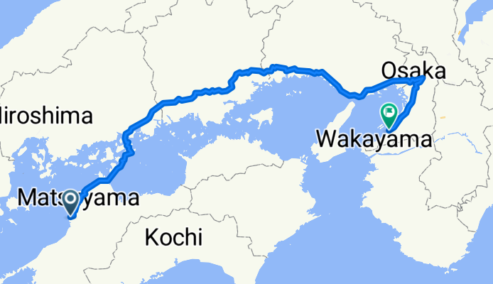
2632-1 ~ 린쿠 타운
A cycling route starting in Masaki, Ehime, Japan.
Overview
About this route
- 28 h 57 min
- Duration
- 479.7 km
- Distance
- 4,630 m
- Ascent
- 4,624 m
- Descent
- 16.6 km/h
- Avg. speed
- 230 m
- Max. altitude

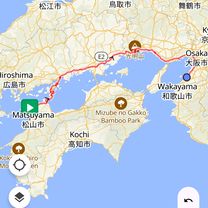
Route photos

Route quality
Waytypes & surfaces along the route
Waytypes
Quiet road
307 km
(64 %)
Cycleway
115.1 km
(24 %)
Surfaces
Paved
95.9 km
(20 %)
Asphalt
91.1 km
(19 %)
Paved (undefined)
4.8 km
(1 %)
Undefined
383.7 km
(80 %)
Continue with Bikemap
Use, edit, or download this cycling route
You would like to ride 2632-1 ~ 린쿠 타운 or customize it for your own trip? Here is what you can do with this Bikemap route:
Free features
- Save this route as favorite or in collections
- Copy & plan your own version of this route
- Split it into stages to create a multi-day tour
- Sync your route with Garmin or Wahoo
Premium features
Free trial for 3 days, or one-time payment. More about Bikemap Premium.
- Navigate this route on iOS & Android
- Export a GPX / KML file of this route
- Create your custom printout (try it for free)
- Download this route for offline navigation
Discover more Premium features.
Get Bikemap PremiumFrom our community
Other popular routes starting in Masaki
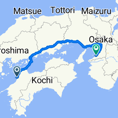 마쓰야마..오사카
- Distance
- 445.5 km
- Ascent
- 5,034 m
- Descent
- 5,025 m
- Location
- Masaki, Ehime, Japan
 나카가와라 406-1, 이요군 마사키조 to 하나조노마치 3-18, 마쓰야마시
- Distance
- 5.7 km
- Ascent
- 18 m
- Descent
- 3 m
- Location
- Masaki, Ehime, Japan
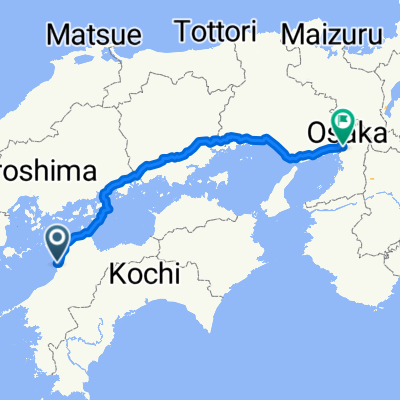 마쓰야마. 오사카
- Distance
- 397.8 km
- Ascent
- 4,831 m
- Descent
- 4,831 m
- Location
- Masaki, Ehime, Japan
 一般県道松山川内自転車道線(重信川自転車道)
- Distance
- 19.3 km
- Ascent
- 154 m
- Descent
- 25 m
- Location
- Masaki, Ehime, Japan
 重信川自転車道 水と緑の癒しのみちコース
- Distance
- 24.3 km
- Ascent
- 209 m
- Descent
- 81 m
- Location
- Masaki, Ehime, Japan
 2025 마쓰야마 to 오사카
- Distance
- 410.3 km
- Ascent
- 4,409 m
- Descent
- 4,408 m
- Location
- Masaki, Ehime, Japan
 쓰쓰이 826, 이요군 마사키조 to 나카가와라 406-1, 이요군 마사키조
- Distance
- 5 km
- Ascent
- 11 m
- Descent
- 0 m
- Location
- Masaki, Ehime, Japan
 2004/04/28松山-四国カルスト
- Distance
- 84 km
- Ascent
- 1,938 m
- Descent
- 662 m
- Location
- Masaki, Ehime, Japan
Open it in the app