
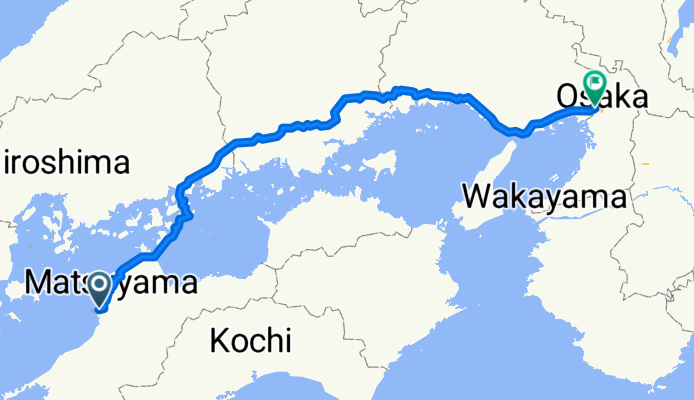
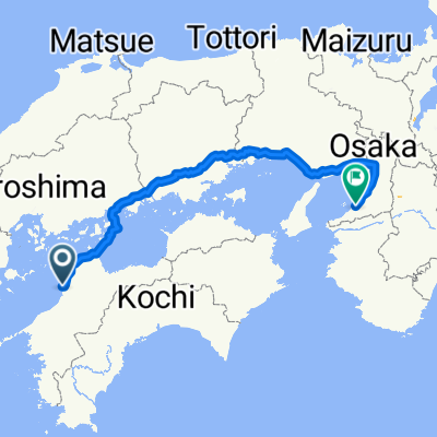
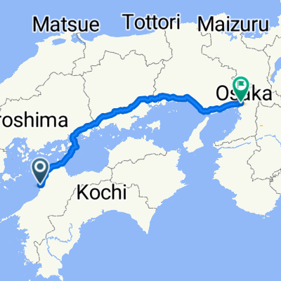
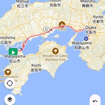
2025 마쓰야마 to 오사카
A cycling route starting in Masaki, Ehime, Japan.
Overview
About this route
- 24 h 50 min
- Duration
- 410.3 km
- Distance
- 4,409 m
- Ascent
- 4,408 m
- Descent
- 16.5 km/h
- Avg. speed
- 230 m
- Max. altitude

Route photos

Route quality
Waytypes & surfaces along the route
Waytypes
Quiet road
266.7 km
(65 %)
Cycleway
90.3 km
(22 %)
Surfaces
Paved
73.9 km
(18 %)
Asphalt
69.8 km
(17 %)
Paved (undefined)
4.1 km
(1 %)
Undefined
336.4 km
(82 %)
Continue with Bikemap
Use, edit, or download this cycling route
You would like to ride 2025 마쓰야마 to 오사카 or customize it for your own trip? Here is what you can do with this Bikemap route:
Free features
- Save this route as favorite or in collections
- Copy & plan your own version of this route
- Split it into stages to create a multi-day tour
- Sync your route with Garmin or Wahoo
Premium features
Free trial for 3 days, or one-time payment. More about Bikemap Premium.
- Navigate this route on iOS & Android
- Export a GPX / KML file of this route
- Create your custom printout (try it for free)
- Download this route for offline navigation
Discover more Premium features.
Get Bikemap PremiumFrom our community
Other popular routes starting in Masaki
 마쓰야마..오사카
- Distance
- 445.5 km
- Ascent
- 5,034 m
- Descent
- 5,025 m
- Location
- Masaki, Ehime, Japan
 まさき泉めぐりコース
- Distance
- 22.5 km
- Ascent
- 53 m
- Descent
- 56 m
- Location
- Masaki, Ehime, Japan
 2004/04/28松山-四国カルスト
- Distance
- 84 km
- Ascent
- 1,938 m
- Descent
- 662 m
- Location
- Masaki, Ehime, Japan
 마쓰야마. 오사카
- Distance
- 397.8 km
- Ascent
- 4,831 m
- Descent
- 4,831 m
- Location
- Masaki, Ehime, Japan
 나카가와라 406-1, 이요군 마사키조 to 하나조노마치 3-18, 마쓰야마시
- Distance
- 5.7 km
- Ascent
- 18 m
- Descent
- 3 m
- Location
- Masaki, Ehime, Japan
 쓰쓰이 826, 이요군 마사키조 to 하나조노마치 3-18, 마쓰야마시
- Distance
- 9 km
- Ascent
- 27 m
- Descent
- 3 m
- Location
- Masaki, Ehime, Japan
 一般県道松山川内自転車道線(重信川自転車道)
- Distance
- 19.3 km
- Ascent
- 154 m
- Descent
- 25 m
- Location
- Masaki, Ehime, Japan
 2632-1 ~ 린쿠 타운
- Distance
- 479.7 km
- Ascent
- 4,630 m
- Descent
- 4,624 m
- Location
- Masaki, Ehime, Japan
Open it in the app