

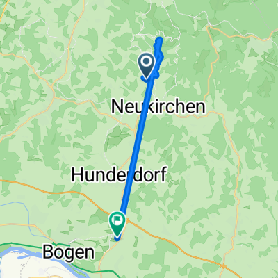
Die "Reiterhof Schober" Acht
A cycling route starting in Neukirchen, Bavaria, Germany.
Overview
About this route
- -:--
- Duration
- 43.2 km
- Distance
- 1,204 m
- Ascent
- 1,132 m
- Descent
- ---
- Avg. speed
- 909 m
- Max. altitude

Route quality
Waytypes & surfaces along the route
Waytypes
Road
22.5 km
(52 %)
Track
1.7 km
(4 %)
Surfaces
Paved
36.3 km
(84 %)
Unpaved
1.7 km
(4 %)
Asphalt
35.9 km
(83 %)
Gravel
0.9 km
(2 %)
Continue with Bikemap
Use, edit, or download this cycling route
You would like to ride Die "Reiterhof Schober" Acht or customize it for your own trip? Here is what you can do with this Bikemap route:
Free features
- Save this route as favorite or in collections
- Copy & plan your own version of this route
- Sync your route with Garmin or Wahoo
Premium features
Free trial for 3 days, or one-time payment. More about Bikemap Premium.
- Navigate this route on iOS & Android
- Export a GPX / KML file of this route
- Create your custom printout (try it for free)
- Download this route for offline navigation
Discover more Premium features.
Get Bikemap PremiumFrom our community
Other popular routes starting in Neukirchen
 Neukirchen-Haggn - Arnstorf
- Distance
- 67.2 km
- Ascent
- 369 m
- Descent
- 355 m
- Location
- Neukirchen, Bavaria, Germany
 Im Wiesengrund 12, Neukirchen nach Im Wiesengrund 12, Neukirchen
- Distance
- 11 km
- Ascent
- 379 m
- Descent
- 378 m
- Location
- Neukirchen, Bavaria, Germany
 Homerun
- Distance
- 17.4 km
- Ascent
- 190 m
- Descent
- 232 m
- Location
- Neukirchen, Bavaria, Germany
 Die "Reiterhof Schober" Acht
- Distance
- 43.2 km
- Ascent
- 1,204 m
- Descent
- 1,132 m
- Location
- Neukirchen, Bavaria, Germany
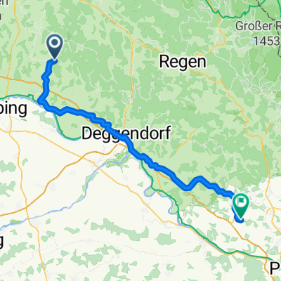
 Autsdorf 1A, Neukirchen nach Bärndorf 29C, Bogen
- Distance
- 13.8 km
- Ascent
- 317 m
- Descent
- 360 m
- Location
- Neukirchen, Bavaria, Germany
 Sparr Mitterfels
- Distance
- 19.3 km
- Ascent
- 273 m
- Descent
- 274 m
- Location
- Neukirchen, Bavaria, Germany
 Neukirchen nach Aicha
- Distance
- 76.9 km
- Ascent
- 368 m
- Descent
- 434 m
- Location
- Neukirchen, Bavaria, Germany
 St 2139, Neukirchen nach St 2139, Neukirchen
- Distance
- 21.2 km
- Ascent
- 137 m
- Descent
- 136 m
- Location
- Neukirchen, Bavaria, Germany
Open it in the app