

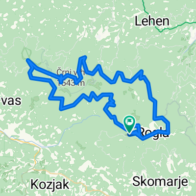
Kolesarska steza rogla 2.1 (Rogla-pesek-Šumik-Osankarca-Pesek-Rogla
A cycling route starting in Vitanje, Vitanje, Slovenia.
Overview
About this route
- -:--
- Duration
- 45.1 km
- Distance
- 683 m
- Ascent
- 683 m
- Descent
- ---
- Avg. speed
- ---
- Max. altitude
Route quality
Waytypes & surfaces along the route
Waytypes
Track
20.8 km
(46 %)
Road
15.3 km
(34 %)
Quiet road
9 km
(20 %)
Surfaces
Paved
21.2 km
(47 %)
Unpaved
23.9 km
(53 %)
Paved (undefined)
13.1 km
(29 %)
Gravel
12.2 km
(27 %)
Continue with Bikemap
Use, edit, or download this cycling route
You would like to ride Kolesarska steza rogla 2.1 (Rogla-pesek-Šumik-Osankarca-Pesek-Rogla or customize it for your own trip? Here is what you can do with this Bikemap route:
Free features
- Save this route as favorite or in collections
- Copy & plan your own version of this route
- Sync your route with Garmin or Wahoo
Premium features
Free trial for 3 days, or one-time payment. More about Bikemap Premium.
- Navigate this route on iOS & Android
- Export a GPX / KML file of this route
- Create your custom printout (try it for free)
- Download this route for offline navigation
Discover more Premium features.
Get Bikemap PremiumFrom our community
Other popular routes starting in Vitanje
 Pohorje1
- Distance
- 43.5 km
- Ascent
- 1,151 m
- Descent
- 1,150 m
- Location
- Vitanje, Vitanje, Slovenia
 Rogla Osankarica Rogla
- Distance
- 39.3 km
- Ascent
- 459 m
- Descent
- 639 m
- Location
- Vitanje, Vitanje, Slovenia
 Kolesarska steza rogla 2.1 (Rogla-pesek-Šumik-Osankarca-Pesek-Rogla
- Distance
- 45.1 km
- Ascent
- 683 m
- Descent
- 683 m
- Location
- Vitanje, Vitanje, Slovenia
 Pohorje 2.
- Distance
- 13.8 km
- Ascent
- 367 m
- Descent
- 368 m
- Location
- Vitanje, Vitanje, Slovenia
 MTB: Žička Kartuzija
- Distance
- 38.5 km
- Ascent
- 972 m
- Descent
- 974 m
- Location
- Vitanje, Vitanje, Slovenia
 MTB: Konjiška gora
- Distance
- 41.5 km
- Ascent
- 1,371 m
- Descent
- 1,370 m
- Location
- Vitanje, Vitanje, Slovenia
 Rogla-Kope (62km)
- Distance
- 62.5 km
- Ascent
- 2,789 m
- Descent
- 2,790 m
- Location
- Vitanje, Vitanje, Slovenia
 RoglaŠumik waterfall and Črno jezero
- Distance
- 49 km
- Ascent
- 1,345 m
- Descent
- 1,336 m
- Location
- Vitanje, Vitanje, Slovenia
Open it in the app