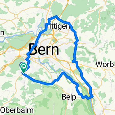
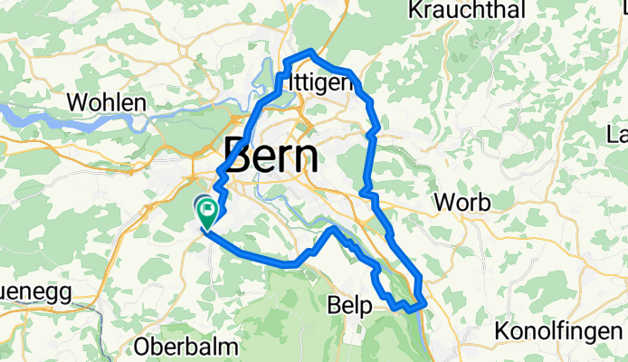
888 Grünes Band Bern modifiè
A cycling route starting in Köniz, Canton of Bern, Switzerland.
Overview
About this route
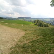
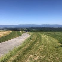
It only takes nine minutes to get right into nature from Bern: this 58-kilometre-long thematic route connects the municipalities around Bern – the Swiss federal city and UNESCO World Heritage Site – and is a wonderful way to spend your free time.
- 2 h 42 min
- Duration
- 40.9 km
- Distance
- 619 m
- Ascent
- 619 m
- Descent
- 15.2 km/h
- Avg. speed
- 663 m
- Max. altitude
Route quality
Waytypes & surfaces along the route
Waytypes
Quiet road
7.4 km
(18 %)
Road
1.2 km
(3 %)
Surfaces
Paved
11.9 km
(29 %)
Asphalt
11 km
(27 %)
Concrete
0.8 km
(2 %)
Undefined
29 km
(71 %)
Continue with Bikemap
Use, edit, or download this cycling route
You would like to ride 888 Grünes Band Bern modifiè or customize it for your own trip? Here is what you can do with this Bikemap route:
Free features
- Save this route as favorite or in collections
- Copy & plan your own version of this route
- Sync your route with Garmin or Wahoo
Premium features
Free trial for 3 days, or one-time payment. More about Bikemap Premium.
- Navigate this route on iOS & Android
- Export a GPX / KML file of this route
- Create your custom printout (try it for free)
- Download this route for offline navigation
Discover more Premium features.
Get Bikemap PremiumFrom our community
Other popular routes starting in Köniz
Emmentaler-Hogerderby- Distance
- 127.8 km
- Ascent
- 1,615 m
- Descent
- 1,615 m
- Location
- Köniz, Canton of Bern, Switzerland
Sensetour by mnh- Distance
- 40.1 km
- Ascent
- 425 m
- Descent
- 425 m
- Location
- Köniz, Canton of Bern, Switzerland
C60+ Borisried-Bütschelegg-Nebel-Sonne- Distance
- 49.1 km
- Ascent
- 825 m
- Descent
- 895 m
- Location
- Köniz, Canton of Bern, Switzerland
Von Bern bis Bulle- Distance
- 63.2 km
- Ascent
- 1,091 m
- Descent
- 876 m
- Location
- Köniz, Canton of Bern, Switzerland
Da Neue Murtenstrasse a Bühlstrasse- Distance
- 89.1 km
- Ascent
- 640 m
- Descent
- 630 m
- Location
- Köniz, Canton of Bern, Switzerland
Rundtour Wohlensee mit Kinderanhänger- Distance
- 32.1 km
- Ascent
- 361 m
- Descent
- 371 m
- Location
- Köniz, Canton of Bern, Switzerland
Köniz-Bremgartenwald-Wohlensee-Wohleiberg-Köniz by mnh- Distance
- 36.4 km
- Ascent
- 466 m
- Descent
- 465 m
- Location
- Köniz, Canton of Bern, Switzerland
De Dorfbachstrasse 58, Köniz a Dorfbachstrasse 60, Köniz- Distance
- 63.5 km
- Ascent
- 1,079 m
- Descent
- 1,079 m
- Location
- Köniz, Canton of Bern, Switzerland
Open it in the app


